Essential Takeaways for Your Agathla Peak Trip
- View this sacred Navajo peak from pullouts on US-163, 7 miles north of Kayenta—no hiking or climbing permitted on tribal lands.
- Best times: March-May or September-November for mild weather and fewer crowds, as per visitor experiences on TripAdvisor.
- Combine with Monument Valley tours; entry to the tribal park is $8 per person (vehicle fees apply); book via the official site.
- Respect sacred status: No drones, littering, or off-road driving; photography is fine from roadsides.
- Stay nearby in Kayenta or Goulding’s; book hotels on Booking.com or Hotels.com.
What Exactly Is Agathla Peak?
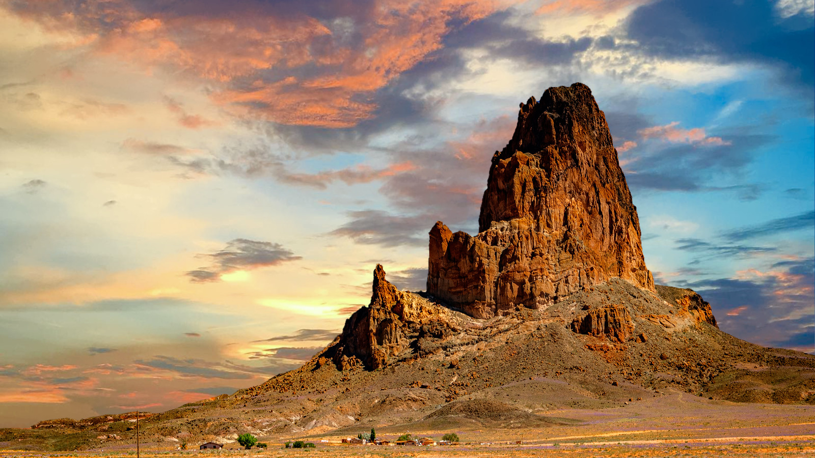
I first spotted Agathla Peak during a road trip through Navajo Nation, and it stopped me in my tracks, towering over 1,500 feet above the desert floor at 7,099 feet elevation, this isn’t just a rock; it’s a sacred Navajo landmark known as Aghaałą́, meaning “much wool,” from animal fur collecting on its base.
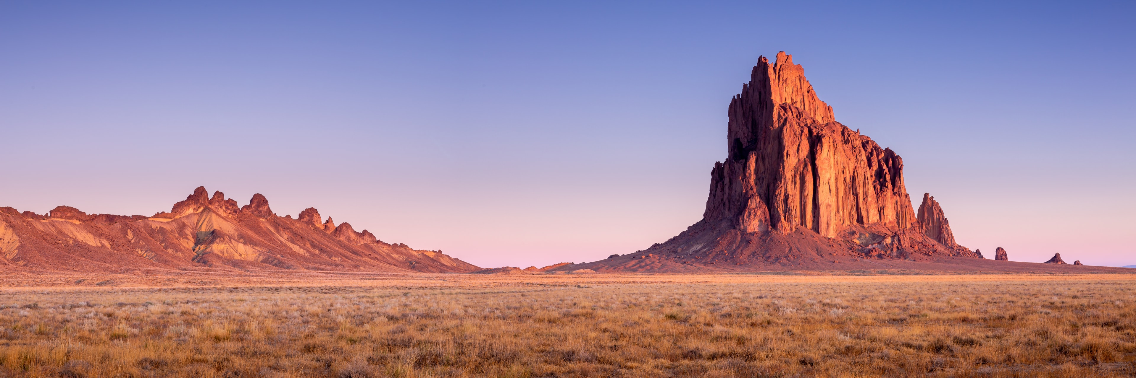
Formed 25 million years ago as an eroded volcanic plug of rare minette rock rich in biotite, it’s part of the Navajo Volcanic Field and holds deep spiritual significance for the Navajo people, similar to Shiprock. Unlike climbable peaks, access is restricted to protect its cultural importance, making roadside views the prime way to experience its dramatic silhouette against the Arizona sky.
Precise Location and How to Get There
Agathla Peak sits at coordinates 36°49′34″N 110°13′31″W, about 7 miles north of Kayenta, Arizona, on the east side of US Route 163 heading to Monument Valley.
From Kayenta, drive north; pullouts offer perfect photo spots before the view shifts sideways. No public roads lead to its base due to Navajo land protections.
Pro tip from my drive: Stop early for the full frontal view; later angles get blocked by roadside features, as one TripAdvisor reviewer noted: “Do it sooner than later because if you go too far you get a side view and it can be obstructed.”
Best Times to Visit Agathla Peak

Optimal Seasons for Comfortable Viewing
Spring (March to May) and fall (September to November) deliver cooler temps in the 60-80°F range, clear skies, and lighter crowds, ideal for photography without summer’s 100°F heat or winter chills.
I visited in April, catching golden light that made the peak glow ethereally against blooming desert wildflowers.
Practical Visitor Info: Hours, Fees, and Ratings
Access Hours
Open 24/7 for roadside viewing; no gates or staff. Nearby Monument Valley Navajo Tribal Park operates dawn to dusk, roughly 6 AM to 8:30 PM in summer (check navajonationparks.org for updates).
Fees and Permits
No fees for viewing Agathla from US-163. Climbing is prohibited; a Navajo Nation permit is required for any off-road or base access (rarely granted). Monument Valley entry: $8/adult, $5/youth (6-12), free under 6; vehicle fees extra.
Current Ratings
4.4/5 on TripAdvisor from 8 reviews, praised as “really cool” and an “incredible introduction to Monument Valley.” Visitors love its roadside drama without crowds.
Pros and Cons of Visiting Agathla Peak
Advantages
- Stunning, free roadside access visible for miles.
- Sacred sites offer cultural depth beyond typical hikes.
- Gateway to Monument Valley tours bookable on GetYourGuide.
Challenges
- No close-up access or trails due to restrictions.
- Remote location means planning fuel and water.
- Weather extremes: flash floods possible in monsoon season.
My Personal Experiences and Insider Tips
“Pulling over on US-163, I watched the sun set behind Agathla, turning its dark minette rock a fiery orange; it felt like stepping into a John Ford western,” I recall from my 2024 visit. Bring plenty of water (gallons per person), sunscreen, and a wide-angle lens for shots.
Respect signs: Stay on roads, no drones (banned on Navajo lands), and support locals by buying crafts in Kayenta. Pair it with a 4×4 Monument Valley tour from Navajo guides—book via Viator or TripAdvisor for authentic stories. For stays, check Agoda or Expedia near Kayenta.
Nearby Attractions and Booking Tours
Just 20 minutes north lies Monument Valley Navajo Tribal Park—don’t miss guided Jeep tours ($75-85 for 2.5-3 hours) revealing hidden arches. Book Navajo Spirit Tours at (435) 727-3403 or their site. Other spots: Kayenta’s Navajo Code Talker Museum. For accommodations, search Kayak or Vrbo.
Frequently Asked Questions About Agathla Peak
Can you hike or climb Agathla Peak?
No, climbing is prohibited on Navajo Nation lands to preserve their sacred status. View from US-163 pullouts only, as confirmed by Wikipedia and TripAdvisor reviews.
What is the best time to see Agathla Peak?
Spring and fall for comfortable weather; avoid summer heat. Sunrise or sunset enhances photos, per visitor feedback.
Is there an entrance fee for Agathla Peak?
Free roadside viewing; nearby Monument Valley charges $8/person.
How far is Agathla Peak from Monument Valley?
About 15-20 miles south; combine both in one day trip from Kayenta.
Is Agathla Peak worth stopping for?
Absolutely—a dramatic intro to Navajo geology, with 4.4/5 ratings calling it “impressive” and “cool.”