Abuja Geographic Information Systems (AGIS): Revolutionizing Land Administration in Nigeria
Nigeria’s Abuja Geographic Information Systems (AGIS) is at the forefront of modern land administration and geographic information management. AGIS provides citizens, businesses, and government entities with efficient, transparent, and accessible land administration services in the rapidly growing Federal Capital Territory (FCT).
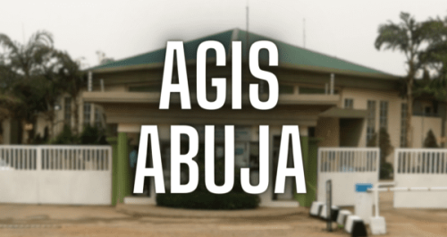
AGIS Abuja
The AGIS was established with a clear vision: to be a world-class center of excellence for land administration and geographic information management. In Abuja, its mission is to ensure accurate and efficient land title registration, provide reliable geographic information, and facilitate sustainable urban development. Using state-of-the-art GIS technology, AGIS streamlines land administration processes and promotes transparency.
Key Services Offered by AGIS
AGIS offers a wide range of services designed to meet its users’ diverse needs. Some of the key services include:
Land Title Registration: AGIS provides a streamlined process for land title registration, ensuring that all land transactions are recorded accurately and securely. This service helps to reduce disputes and provides legal certainty to landowners.
Geographic Information Services: Through its advanced GIS technology, AGIS offers detailed maps and spatial data that support urban planning, infrastructure development, and environmental management. These services are essential for decision-makers in both the public and private sectors.
Land Information Services: AGIS maintains a comprehensive database of land information, including cadastral maps, property boundaries, and ownership details. This information is accessible to the public, promoting transparency and accountability in land administration.
Customer Service and Support: AGIS is committed to providing excellent customer service, with a dedicated help desk and online portals to assist users with their inquiries and transactions. This ensures that stakeholders can access information and support efficiently.
AGIS’ Impact on Urban Development
Abuja’s sustainable development relies heavily on AGIS. AGIS supports urban planners, developers, and policymakers by providing accurate and reliable land information. With detailed geographic data available, land can be allocated efficiently for residential, commercial, and public use, contributing to the city’s orderly growth.
Further, AGIS’ efforts to digitize land records and implement transparent processes have significantly reduced corruption and land disputes. Investment and economic development in the FCT have been enhanced as a result.
Innovations and Future Plans
To meet the evolving needs of its users, AGIS continues to innovate and improve its services. In order to further enhance the accuracy and security of its data, the organization is integrating advanced technologies such as remote sensing, drone mapping, and blockchain. Additionally, AGIS aims to raise awareness of the importance of proper land administration and the benefits of GIS technology through outreach and education programs.
AGIS aims to set new standards for land administration in Nigeria and beyond in the coming years. AGIS is poised to play a pivotal role in urban development and land management in Abuja by continuously improving its systems and processes.
Get in touch.
Open: Monday-Friday 9:00 a.m.–3:00 p.m.
Address: 4 Peace Drive, Central Area, Abuja, FCT.
Website: www.agis.fcta.gov.ng
Frequently Asked Questions About AGIS Abuja
1. What is the Abuja Geographic Information System (AGIS)?
AGIS manages land administration and geographic information systems in the Federal Capital Territory (FCT) of Nigeria. To streamline and modernize land registration processes, provide accurate geographic data, and support urban planning and development in Abuja, it was established.
2. What services does AGIS offer?
AGIS provides a range of services, including:
Land title registration and documentation
Geographic information services (GIS) such as mapping and spatial data analysis
Land information services, which include maintaining a database of cadastral maps and property records
Customer support and assistance with land-related inquiries and transactions
3. How can I register my land with AGIS?
To register land with AGIS, follow these steps:
Obtain and complete the appropriate application forms from AGIS.
Submit the completed forms along with the required documents, which typically include proof of ownership, survey plans, and identification.
Pay the necessary fees.
AGIS will then process your application, conduct verification, and issue a Certificate of Occupancy (C of O) or other relevant land title documents.
4. How do I access geographical information and maps from AGIS?
The AGIS customer service center and online portals provide access to geographic information and maps. For urban planning, infrastructure development, and environmental management, the information includes cadastral maps, property boundaries, and other spatial data.
5. What is a Certificate of Occupancy (COC)?
An AGIS Certificate of Occupancy (C of O) certifies the holder’s right to occupy and use a parcel of land. In various land transactions and developments, it serves as proof of ownership.
6. Can AGIS help resolve land disputes?
Yes, AGIS can help resolve land disputes by providing accurate and up-to-date land information and records. This helps clarify ownership and boundaries, reduce conflicts, and ensure legal certainty.
7. What are the fees associated with AGIS services?
AGIS service fees vary depending on the type of service and the specific requirements of the application. Common fees include land title registration, survey plan processing, and geographic information services. AGIS offices or their official website can provide fee schedules.
8. How can I contact AGIS for support or inquiries?
You can contact AGIS through the following channels:
Visit the AGIS office located at No. 4, Peace Drive, Central Business District, Abuja, Nigeria
Call their customer service hotline
Sending an email to their official support email address
Access their services and information through the AGIS website
9. What are AGIS’ operating hours?
AGIS operates from Monday to Friday, typically between 8:00 AM and 3:00 P.M. It is advisable to check their official website or contact their office for any updates on operating hours or holiday schedules.
Conclusion
The Abuja Geographic Information System (AGIS) is a testament to the power of technology in transforming land administration and urban development. Through its innovative services and commitment to excellence, AGIS is making a significant impact on residents’ lives and the growth of the Federal Capital Territory. For years to come, AGIS will remain a key player in Abuja’s sustainable development, ensuring that the city remains a vibrant and well-organized capital as it continues to evolve and embrace new technologies.
Key Takeaways
Efficient Land Administration: AGIS leverages advanced GIS technology to streamline land registration and promote transparency.
Support for Urban Development: Accurate geographical data from AGIS aids urban planning, infrastructure development, and environmental management.
Reduction of Land Disputes: Digitization of land records and transparent processes by AGIS reduce corruption and land disputes.
Innovative Future Plans: AGIS is exploring new technologies like drone mapping and blockchain to enhance its services.
Accessible Services: AGIS provides a wide range of services, including land title registration, geographic information services, and customer support, ensuring accessibility for all stakeholders.
For more information, visit the AGIS website.


