advertisement
Green Mountain National Forest Vermont: The Complete Guide to Hikes, Camping & Fall Foliage
Fact-Checked By Maya Whitfield, Senior Travel Editor at WakaAbuja
Green Mountain National Forest spans nearly 400,000 acres across southern and central Vermont, split into two distinct sections. It is the state’s largest contiguous public land, offering free dispersed camping, over 900 miles of multi-use trails, and some of New England’s most intense fall foliage. Unlike the crowded White Mountains to the east, this forest feels genuinely local and uncrowded, even during peak leaf-peeping weekends.
The USDA Forest Service website will confirm the acreage and list campground names with a clinical efficiency that tells you nothing about which sites fill first or which trailhead parking lot turns into chaos by 9 a.m. on a Saturday in October. I have been poking around these mountains since I moved to New England, and I have made the predictable mistakes, like showing up to a trailhead at noon on a foliage weekend and finding nowhere to park and camping in a site that flooded during an overnight thunderstorm. This guide fills in the practical gaps the official pages skip.
Jump to: Forest Overview | Best Hikes | Camping Guide | Fall Foliage Plan | Gateway Towns | Sample Itineraries | FAQs
Key takeaways
- The forest is split into a larger southern section near Manchester and Rutland and a smaller northern section around Middlebury and Bristol.
- There is no entrance fee. Dispersed camping in designated areas is free, and developed campgrounds cost roughly $20 to $30 per night.
- Peak fall foliage typically hits during the first two weeks of October, with higher elevations turning in late September.
- Mount Abraham via the Long Trail and the Lye Brook Falls trail are two standout day hikes that represent the best of the forest’s terrain.
- Cell service is unreliable across most of the forest. Download offline maps before you leave pavement.
- Mud season, roughly late March through early May, closes many forest roads and turns trails into deep, boot-swallowing muck. The Forest Service actively discourages hiking during this window to prevent trail erosion.
What exactly is Green Mountain National Forest?
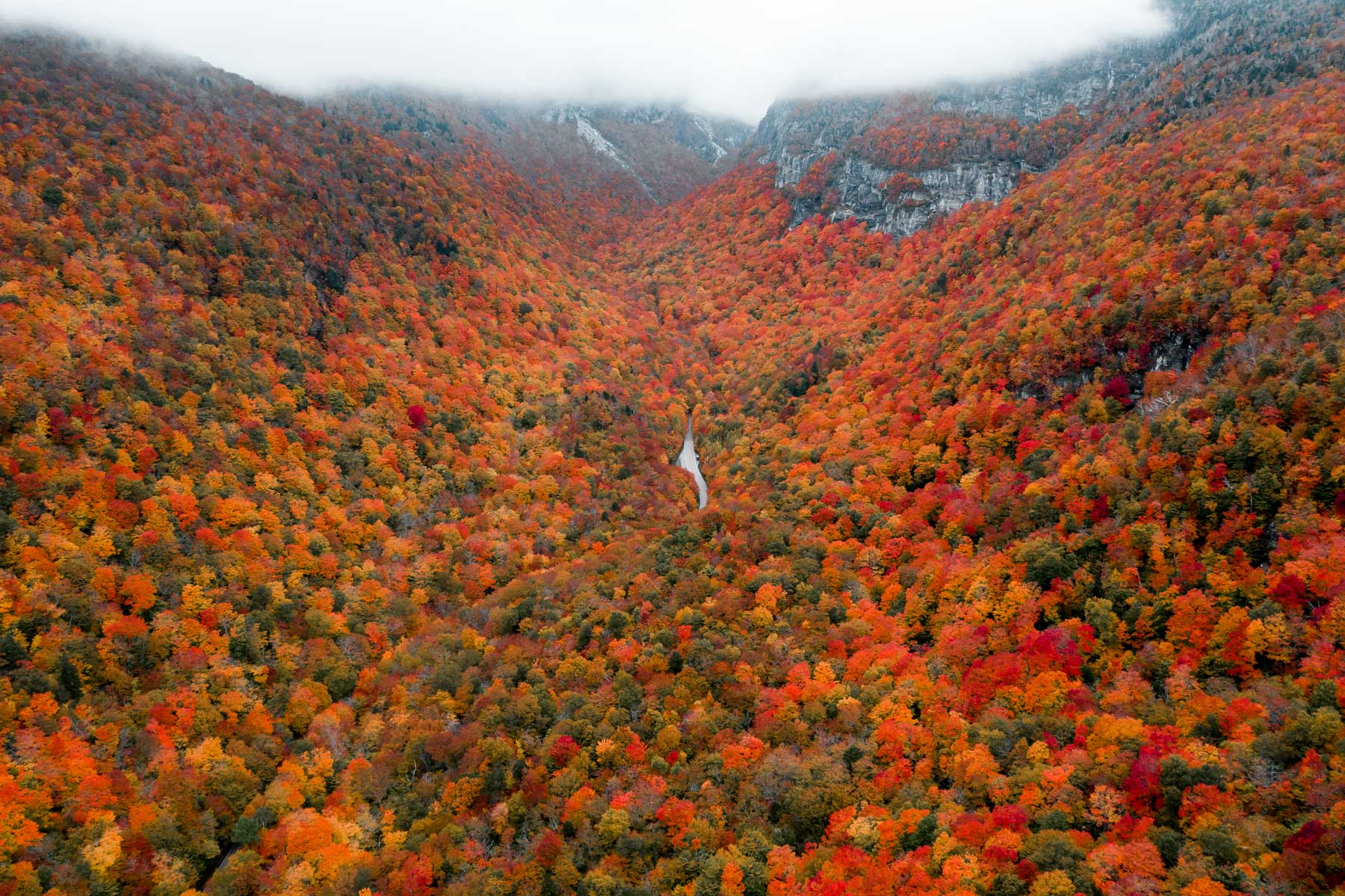
Green Mountain National Forest is a federally managed public land holding roughly 400,000 acres along the spine of Vermont’s green mountains. It is not a single contiguous park like Yosemite. It is a patchwork of protected parcels woven between private land, state parks, and small towns, divided into a larger southern block and a smaller northern block. The southern section stretches from roughly Bennington up to Killington. The northern section runs from Middlebury up toward the Mad River Valley. Between them sits a gap of private and state-managed land.
This fragmented structure confuses first-time visitors who expect a single obvious entrance gate. There is not one. You access the forest through a network of state highways and unpaved Forest Service roads that branch off routes like VT-100, VT-30, and US-7. The official Forest Service website lists road statuses, but the real on-the-ground condition of those roads depends heavily on recent rain, snowmelt, and how recently a grader last passed through. Call the ranger district office in Manchester or Rochester before you head up a road marked “unimproved” if your vehicle lacks high clearance.
Maya’s honest take: “This forest feels different from the big-name national parks out west. It is quieter, more understated, and takes more work to figure out. The reward for that work is solitude on trails that, in a more famous park, would be shoulder-to-shoulder busy.”
Best hikes in Green Mountain National Forest
The forest contains sections of the Long Trail and the Appalachian Trail, plus dozens of shorter day hike loops. The terrain varies from gentle river walks to exposed alpine ridge scrambles. Below are the four hikes I recommend starting with. Each gives you a distinctly different slice of the forest.
@lauren.mae16 When you’re bored & remember you literally live in Vermont. There are hikes on every road with the most beautiful views! ⛰️ #vermont #hike #hiking #hikingadventures #vermonthiking #vermonttiktok #vermontlife
Mount Abraham via the Long Trail (Battell Trail approach)
This 5.8-mile round trip starts from the Battell Trailhead in Lincoln and climbs steadily through hardwood forest before breaking above treeline onto the exposed alpine summit. Mount Abraham is one of only five Vermont peaks with true alpine vegetation above 4,000 feet, and the 360-degree view across the Champlain Valley to the Adirondacks on a clear day is the single best vista in the forest. The final half-mile is rocky and steep. Bring a wind layer. The summit ridge catches full weather with no shelter.
Lye Brook Falls Trail
A 4.6-mile round trip from a trailhead east of Manchester Center. The trail follows an old logging railroad grade alongside Lye Brook, climbing gradually to a 125-foot waterfall, one of the tallest in Vermont. The falls cascade down a broad rock face into a shaded pool. This hike is popular for good reason, so arrive before 8:30 a.m. on weekends to secure parking and a quiet experience at the falls.
Bald Mountain (Bennington area)
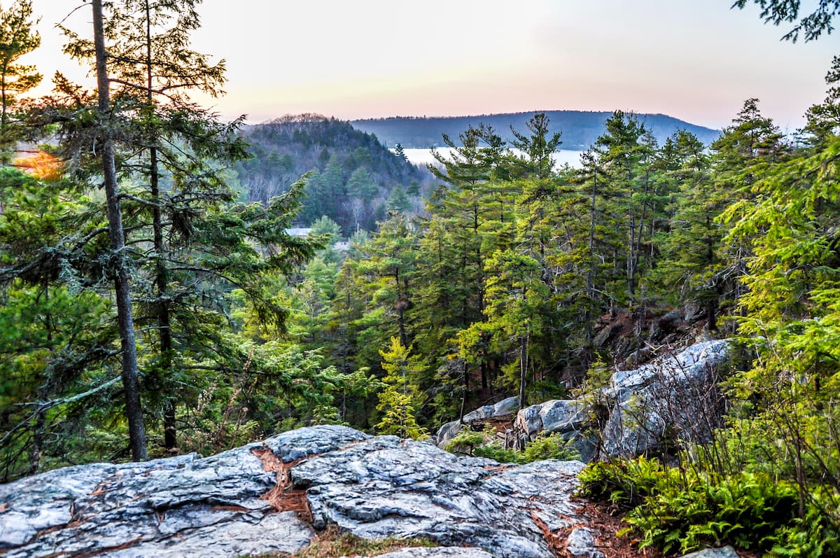
A shorter, 3-mile out-and-back that punches above its weight. The trailhead sits off a gravel road near Woodford. The summit opens onto a broad rock ledge with a sweeping view of the Bennington valley and the Taconic Range to the west. This is a strong choice for a quick morning hike or a sunset spot if you time the descent carefully with a headlamp.
Texas Falls Recreation Area
More of a walk than a hike, but worth mentioning because it is fully accessible. A short loop boardwalk and paved path lead to a dramatic gorge where the New Haven River funnels through narrow polished rock. The falls are loud and photogenic, and the picnic area makes this a good stop if you are driving between the northern and southern sections of the forest.
Camping in Green Mountain National Forest: developed campgrounds and dispersed sites
Camping inside the forest falls into two categories: developed campgrounds with fees, potable water, and vault toilets, and dispersed primitive camping that is free but offers zero amenities. The developed campgrounds generally operate from late May through mid-October, though exact dates shift with weather and budget decisions. Silver Lake, Hapgood Pond, and Greendale are the three most established campgrounds inside the southern section. Chittenden Brook and Moosalamoo serve the northern section.
Dispersed camping is permitted in most areas of the forest outside of designated recreation zones and within 100 feet of a forest road or trail, provided you are at least 200 feet from any water source. You do not need a permit. You do need to practice Leave No Trace at a level that goes beyond the basics. I have found fire rings stuffed with half-burned plastic and food waste at dispersed sites that were clearly used as party spots. Pack out everything, including food scraps, and do not build a fire ring where one already exists in a poorly drained area. Check the current fire danger rating on the Forest Service website before you light anything.
Maya’s honest take: “Camped at a dispersed site off Forest Road 10 near the Long Trail crossing once in mid-May. It rained heavily overnight and the road turned to deep mud by morning. It took an hour of careful low-gear driving to get back to pavement. Lesson: check the forecast and have a vehicle that can handle wet clay.”
When and where to see fall foliage
Fall foliage in Green Mountain National Forest is not a single event. It is a rolling wave that starts at the highest elevations in late September and works downhill into the valleys through mid-October. The forest’s mix of sugar maple, red maple, birch, and beech produces the deep reds and bright oranges people fly across the country to photograph. The Forest Service and Vermont tourism agencies publish regular foliage reports, but the real rhythm is simpler than the hype makes it seem.
Higher elevation routes like the Mount Abraham summit trail and the gap roads (Brandon Gap, Middlebury Gap, Appalachian Gap) peak first, usually during the final week of September or the first days of October. Valley routes like the drive along VT-100 between Killington and Waitsfield peak roughly a week to ten days later. If you can only visit for one weekend, aim for the first weekend in October. You will catch the upper elevations at or near peak and the valleys just starting to turn.
Late September
- Peak color above 3,000 feet elevation
- Summit trails and gap roads show brightest reds
- Valleys still mostly green
First week of October
- Sweet spot for most visitors
- High elevations still strong, mid-elevations peaking
- Busiest weekend of the year on VT-100
Mid-October
- Valleys and southern lowlands peak
- Upper elevations often past peak, leaves dropping
- Fewer crowds, still beautiful in lower towns
Gateway towns: where to eat, sleep, and resupply
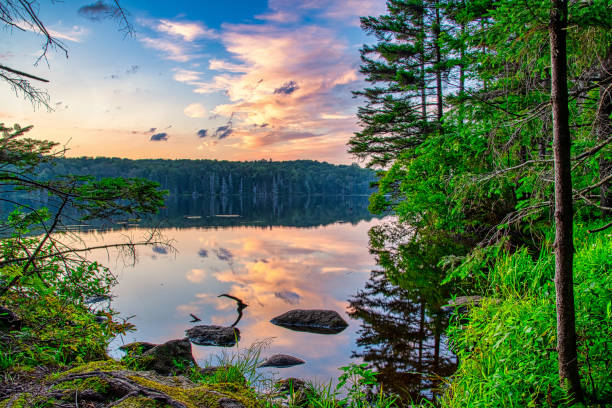
The forest lacks any town inside its boundaries, but several small Vermont communities sit right on its edges and function as practical base camps. Each has a distinct personality and access profile.
Manchester
Southern section hub. The largest and most amenity-rich gateway town. Good bookstores, solid coffee, a well-stocked supermarket, and the closest decent lodging to the Lye Brook Falls and Mount Equinox trailheads. It leans more upscale outlet-shopping than rugged mountain town, but it is practical and comfortable.
Rutland
Central access point. A larger, grittier working city that puts you close to the central section of the forest, including the Killington area and the southern Long Trail access. Accommodation is cheaper here than in Manchester or Middlebury. Best for hikers prioritizing trail access over charm.
Middlebury
Northern section hub. A classic college town with good bakeries, a food co-op, and the closest services to the Mount Abraham and Moosalamoo trailheads. Lodging fills quickly during fall foliage and college events. Book well ahead.
Waitsfield and Warren
Mad River Valley access. Tucked between the northern and southern sections of the forest. Excellent food scene, farm stands, and a relaxed, community-rooted feel. A strong base for exploring the Appalachian and Lincoln gaps and the northern trailheads without the Middlebury crowds.
Sample itineraries for a weekend or a long weekend
These plans assume late spring through fall access and a willingness to start early. Adjust based on your group’s pace and how much time you want to spend lingering at overlooks.
One-day highlights sampler (southern section)
Start in Manchester. Hike Lye Brook Falls first thing, arriving by 8 a.m. to beat the crowds. After the hike, drive north on VT-30 and then east on US-4 toward Killington, stopping at the Texas Falls Recreation Area for a short walk. Have a late lunch in Rutland, then take VT-100 south back toward your starting point. This loop gives you a solid cross-section of the southern forest in a single full day.
Two-day weekend: north and south sampler
Day one focuses on the southern forest. Hike Bald Mountain in the morning, then drive north along the forest’s edge roads to the Texas Falls area. Camp overnight at Silver Lake Campground or a dispersed site off a forest road you have scouted in advance. Day two, drive north to the Battell Trailhead in Lincoln and hike Mount Abraham. Descend by early afternoon and stop at a bakery in Middlebury before heading home. This itinerary crosses both sections of the forest and gives you one major summit and one waterfall hike.
Three-day fall foliage deep dive
Day one stays in the southern forest around Manchester. Hike Mount Equinox or Lye Brook Falls, then spend the afternoon driving the back roads around Peru and Landgrove for foliage. Day two moves north through the gap roads: Brandon Gap, Middlebury Gap, and Appalachian Gap, stopping at overlooks and short trailheads along the way. Spend the night near Waitsfield. Day three hikes a section of the Long Trail from Lincoln Gap and then loops back through Rochester for a late lunch before the drive home. This is the itinerary for someone who cares more about photography and leaf-peeping than peak-bagging.
Mistakes to avoid in Green Mountain National Forest
Most of the problems I have seen in this forest, including my own, come down to underestimating the weather, the roads, or the crowds during a narrow foliage window. Here is what to watch for.
- Hiking during mud season. The Forest Service actively asks people to stay off trails from late March through early May. The trails are soft, you cause lasting erosion damage, and honestly, the hiking is miserable anyway.
- Relying on phone GPS without a backup. The forest has large dead zones. Download offline maps on AllTrails, Gaia GPS, or Google Maps before you leave. Carry a physical map or a paper printout for longer backcountry routes.
- Arriving at popular trailheads after 9 a.m. on October weekends. Lye Brook Falls, Mount Abraham, and Texas Falls parking areas fill early during foliage season. If you arrive late, you will circle or park illegally and risk a ticket.
- Driving unimproved Forest Service roads in a low-clearance car after rain. Some roads turn to deep, slippery mud. Check with the ranger station about current conditions on specific roads before committing.
- Underestimating summit weather. The exposed peaks of Mount Abraham and Killington can be 20 to 30 degrees colder than the trailhead, with wind strong enough to knock you off balance. Pack an insulating layer and a rain shell even if the valley forecast looks clear.
- Not carrying enough water. Streams and springs are common but not always reliable, especially in late summer. Carry at least two litres per person for any hike over five miles.
- Burning trash or leaving food scraps in dispersed campsites. This attracts bears and rodents and degrades the site for everyone else. Pack out absolutely everything.
Frequently asked questions
Is Green Mountain National Forest free to enter?
Yes. There is no entrance fee for Green Mountain National Forest. You can drive in, hike, and camp at dispersed sites without paying a cent. Developed campgrounds do charge a nightly fee, typically between $20 and $30, and some day-use areas like Hapgood Pond have a small parking charge during summer.
Where is the best place to see fall colors in Green Mountain National Forest?
The drive along VT-100 between Killington and Waitsfield is the classic foliage route, with the forest pressing in on both sides. For elevated views, the summits of Mount Abraham and Bald Mountain deliver wide-angle foliage panoramas. The gap roads, particularly Middlebury Gap and Brandon Gap, provide excellent mid-elevation color with multiple pull-off overlooks.
Do you need a bear canister for camping?
Bear canisters are not legally required in Green Mountain National Forest, but proper food storage is essential. Black bears are active throughout the forest. Use a bear hang, a canister, or a locked vehicle to store all food, toiletries, and trash overnight. Never keep food in your tent.
What is the best hike for kids?
Texas Falls Recreation Area is ideal for young children and anyone with limited mobility. The boardwalk loop is short, flat, and wheelchair accessible. For older kids who can handle some elevation, the Bald Mountain trail is short enough to hold their attention and rewards the climb with a big-view summit.
Are dogs allowed on trails and in campgrounds?
Yes, dogs are allowed on trails and in campgrounds throughout Green Mountain National Forest. They must be leashed in developed recreation areas and campgrounds. On backcountry trails, voice control is required. Pack out all dog waste and carry enough water for your dog, particularly on ridge hikes where water sources are scarce.
What is the difference between the northern and southern sections?
The southern section is larger, more accessible from major towns like Manchester and Rutland, and contains the more popular hikes like Lye Brook Falls. The northern section is quieter, higher in elevation, and includes the Mount Abraham and Moosalamoo areas. The two sections are separated by roughly 20 miles of private and state-managed land around the Middlebury area.
When does snow arrive and when do forest roads close?
Snow typically begins accumulating at higher elevations in November. Most unpaved Forest Service roads close to vehicle traffic by late November or early December and reopen in May, depending on mud season conditions and snowmelt. Check the Forest Service road status page before planning any trip between November and May.
Plan your trip: booking platforms we trust
For Green Mountain National Forest specifically, lodging and tours matter less than maps and campsite info, since most hiking is self-guided and free. I use the platforms below for nearby accommodation and for trail data before I leave home.
Best for finding inns and motels in Manchester, Middlebury, and Waitsfield with flexible cancellation.
Best for whole cabins and chalets near the forest boundary, especially for foliage season group trips.
Best for honest recent reviews of trail conditions and restaurant recommendations in gateway towns.
Best for bundling flights into Burlington or Boston with a rental car and a Manchester or Rutland hotel.