advertisement
Lake Kariba: Complete Guide to the World’s Largest Man-Made Lake
Fact-Checked By Maya Whitfield, Senior Travel Editor at WakaAbuja
Lake Kariba is the largest man-made lake in the world by volume, a 223-kilometer-long reservoir straddling the border of Zambia and Zimbabwe. It was formed when the Kariba Dam sealed off the Zambezi River in 1958, and it holds more water than any reservoir on Earth. Today it supports a major fishing industry, dense wildlife populations, and a growing tourism trade on both shores.
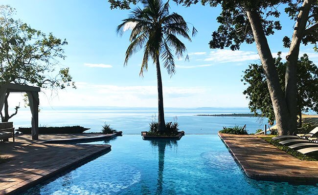
Wikipedia will give you the raw statistics, and those statistics matter. But most pages stop there, leaving you to stitch together the geography, the wildlife, the safety questions, and the practical reality of visiting from scattered sources. I have spent time on the Zimbabwean side of this lake, and the thing that stays with you is not the water volume statistic; it is the scale. The lake stretches so far that on a clear day the opposite shore fades into a haze like an inland sea.
This guide covers the facts, the context, and the stuff you actually need to know before you go, including the safety questions that have become newly relevant this month.
Jump to: Key Facts | How It Formed | Geography & Border | Size Comparisons | Wildlife & Ecology | Safety | Visiting Guide | FAQs
Key takeaways
- Lake Kariba is the world’s largest artificial lake by volume, holding roughly 185 cubic kilometers of water behind the Kariba Dam.
- The lake stretches 223 kilometers along the Zambezi River and is up to 40 kilometers wide at its broadest point.
- It sits on the border between Zambia and Zimbabwe, with each country managing its own shoreline, fisheries, and tourism infrastructure.
- The filling of the lake between 1958 and 1963 triggered a series of earthquakes, some over magnitude 5, due to the immense weight of water on the underlying rock.
- The lake supports a major kapenta fishery, dense populations of Nile crocodiles and hippos, and world-class tigerfish angling.
- While the lake is a major tourism draw, safety around wildlife and on the water is a genuine concern, and recent ferry operations have raised serious questions about vessel standards.
Lake Kariba key facts and figures
These are the numbers most people come searching for, drawn from the most recently available dam authority and geological survey data. They matter because Kariba is not just large in African terms; it is large in planetary terms.
Length: 223 kilometres (139 miles)
Maximum width: 40 kilometres (25 miles)
Surface area: 5,580 square kilometres (2,154 square miles)
Storage capacity: 185 cubic kilometres (44 cubic miles)
Average depth: 29 metres (95 feet)
Maximum depth: 97 metres (318 feet)
Dam completed: 1959, with the lake reaching full capacity in 1963
How Lake Kariba was formed
Lake Kariba exists because the Kariba Dam was built across the Kariba Gorge on the Zambezi River. Construction began in 1955 under the Federation of Rhodesia and Nyasaland, a colonial-era political entity that no longer exists. The dam wall was completed in 1959, and the reservoir behind it began filling immediately. It took five years, until 1963, for the lake to reach its full operating level. The name “Kariba” comes from a local Tonga word, and the dam itself is named after the gorge it plugged.
The human cost of the lake’s creation is rarely discussed in the raw statistics. The rising water displaced roughly 57,000 Tonga people from their ancestral homes along the Zambezi floodplain. Many were relocated to inland resettlement areas that were less fertile and lacked access to the river that had structured their lives. This displacement remains a sensitive and contested chapter in the region’s modern history. The ecological cost was also severe. As the valley flooded, thousands of animals were stranded on newly formed islands, and a massive rescue operation, Operation Noah, worked to relocate as many as possible. Many animals drowned. The event was one of the largest wildlife rescue efforts ever attempted, and its mixed legacy still shapes conservation thinking around large dam projects today.
Geography: the Zambia-Zimbabwe border and key towns
Lake Kariba does not belong to one country. It sits directly on the boundary between Zambia, which controls the northern shore, and Zimbabwe, which controls the southern shore. The lake is roughly 45 percent in Zambia and 55 percent in Zimbabwe by surface area, depending on water levels, but both countries have equal rights to fish and navigate it. The border itself runs down the middle of the lake, following the former course of the Zambezi River.
The largest town on the Zimbabwean side is Kariba, a purpose-built settlement near the dam wall. It serves as the primary hub for houseboat charters, fishing operators, and the ferry terminal. On the Zambian side, the main town is Siavonga, also near the dam, which has grown into a modest resort and fishing center. Further west along the Zimbabwean shore sits Binga, a much smaller town serving the Tonga community and a growing but still underdeveloped tourism sector. On the Zambian side further north is Sinazongwe, a quieter settlement known for its kapenta fishing industry.
The lake’s western end merges into the Matusadona National Park on the Zimbabwean shore, a protected area known for its elephant and lion populations and, historically, for its black rhino population before poaching devastated it in the 1990s. The eastern end near the dam wall is narrower and deeper, with steep rocky shores. The western basin broadens out into shallow, island-dotted waters that support the richest wildlife habitat.
How Lake Kariba compares to other giant reservoirs
Kariba is the largest artificial lake by volume, but it is not the largest by surface area. That distinction belongs to Lake Volta in Ghana. The comparison table below clarifies how these giant reservoirs stack up. The numbers are approximate and drawn from the respective dam authorities and geological surveys.
Lake Kariba (Zambia/Zimbabwe)
- Volume: 185 km³
- Surface area: 5,580 km²
- Length: 223 km
- Dam completed: 1959
Lake Volta (Ghana)
- Volume: 148 km³
- Surface area: 8,502 km²
- Length: 400 km
- Dam completed: 1965
Three Gorges Reservoir (China)
- Volume: 39 km³
- Surface area: 1,084 km²
- Length: 600 km
- Dam completed: 2003
Lake Nasser (Egypt/Sudan)
- Volume: 132 km³
- Surface area: 5,250 km²
- Length: 550 km
- Dam completed: 1970
Kariba holds more water than Three Gorges by a factor of nearly five, despite Three Gorges being longer and far more famous. That volume statistic is the one that earns Kariba its “world’s largest” title, and it is the fact most other pages get wrong or oversimplify.
Wildlife and ecology: what lives in and around the lake
The lake is ecologically complex and, in some ways, still unsettled. When the valley flooded, the riverine ecosystem was destroyed and replaced by a deep, still-water lake. The most economically important species introduced to the new lake was the kapenta, a small sardine-like fish brought from Lake Tanganyika in the 1960s. Kapenta now supports a major commercial fishery on both the Zambian and Zimbabwean shores, with fleets of small boats using lights at night to attract the fish to the surface before netting them.
Alongside the kapenta fishery, Lake Kariba has become one of the world’s premier destinations for tigerfish angling. The tigerfish is a ferocious freshwater predator with prominent teeth and a reputation for explosive strikes. Anglers travel from across southern Africa and internationally to fish for it, and the lake hosts regular fishing competitions. The lake also supports large populations of Nile crocodiles and hippos, both of which pose a real and ongoing safety risk to people living and working along the shoreline. Fish eagles are ubiquitous, their call one of the defining sounds of the lake. On the Zimbabwean shore, Matusadona National Park protects elephants, lions, and a struggling rhino population that was decimated by poaching but has seen modest recovery efforts in recent years.
The earthquakes Lake Kariba causes
Lake Kariba is one of the best-documented cases of reservoir-induced seismicity in the world. The sheer weight of 185 cubic kilometers of water pressing down on the Earth’s crust changed the stress balance in the underlying rock. Since the lake began filling in 1958, the region has experienced more than 20 earthquakes of magnitude 5 or greater. The largest, a magnitude 6.1 event, struck in 1963 just as the lake approached its full level.
Most of these quakes occur in the deeper eastern basin near the dam wall, where the water is deepest and the pressure on the crust is greatest. The mechanism is well understood: the added water weight increases pore pressure in the rock, reducing the friction that normally keeps faults locked, allowing them to slip. This is the same process documented at other large reservoirs around the world, but Kariba remains one of the clearest and most studied examples. The earthquakes are not a reason to avoid the region; they have been a known feature of the lake for decades, but they are a reminder that the lake is not a purely natural feature. It is a human-made structure that changed the geology of the region in measurable ways.
Safety on Lake Kariba: what you need to know
Safety on Lake Kariba falls into two categories: the wildlife and the water itself. The wildlife risks are well known to locals but often underestimated by visitors. Nile crocodiles are present throughout the lake and are most active near shorelines at dawn and dusk. Hippos are responsible for more human fatalities in Africa than any other large animal, and Lake Kariba has a dense hippo population. They are unpredictable, territorial, and capable of capsizing small boats. Swimming from boats or from the shoreline is not safe in most areas. The local rule is simple: do not enter the water except at designated, locally confirmed safe swimming spots, and even then, ask a local first.
The water and vessel safety situation is more complicated. On August 12, 2026, a passenger ferry operating on the lake capsized, and multiple international news outlets, including the BBC and The Guardian, reported a significant loss of life. The full details and final casualty figures are still being confirmed as authorities investigate. This tragedy has brought renewed attention to long-standing concerns about vessel maintenance, overcrowding, and safety enforcement on the lake’s passenger ferries. If you plan to travel on the lake, book with established operators, ask directly about safety equipment and passenger limits, and check recent reviews and any official travel advisories before you go. The lake is a working transport corridor and a tourism destination, and the standards between operators vary widely.
Visiting Lake Kariba: a practical guide
The most common way to experience Lake Kariba as a visitor is on a houseboat safari. These boats, ranging from modest self-catered pontoons to fully staffed luxury vessels, cruise slowly along the shoreline, stopping at fishing spots, wildlife viewing areas, and quiet coves. Most depart from Kariba town on the Zimbabwean side or Siavonga on the Zambian side. A typical three-day houseboat trip includes meals, fishing gear, and a tender boat for game viewing, with prices varying enormously depending on the operator and the level of comfort.
The best time to visit is the dry season, roughly May through October, when animals concentrate near the water and the weather is cooler and drier. November through March brings heat, humidity, and the rainy season, which makes game viewing harder and can make the lake choppy during storms. Fishing for tigerfish is best from September through December. Matusadona National Park, accessible by boat from the lake, offers walking safaris and game drives with far fewer crowds than the more famous parks in Zimbabwe like Hwange or Mana Pools. Bring cash in US dollars, as card facilities are unreliable, and book your houseboat or lodge through a reputable operator with recent reviews. The lake rewards slow travel. Three nights on a houseboat will give you a far better sense of the place than a rushed one-night trip.
Maya’s honest take: “The scale of Lake Kariba is hard to describe until you are on it. Standing on the deck of a houseboat at night, with the Milky Way overhead and the sound of hippos somewhere out in the dark, you understand why this place gets under people’s skin. Just stay out of the water.”
Mistakes to avoid when visiting or researching Lake Kariba
These are the errors that come up repeatedly in travel forums, local conversations, and my own planning mistakes. Most are easy to avoid with a bit of forethought.
- Assuming you can swim wherever you want. The lake is home to large crocodile and hippo populations. Swimming from boats or random shorelines is genuinely dangerous. Only swim where a local operator explicitly tells you it is safe.
- Underestimating the distances. Lake Kariba is huge. Driving from Kariba town to Binga on the Zimbabwean side takes the better part of a day. Plan your logistics around the lake’s scale, not the map distance.
- Booking the cheapest houseboat operator without checking reviews. The gap between a good operator and a bad one is enormous, in both comfort and safety. A few dollars saved per night is not worth a boat that breaks down or a crew that cuts corners.
- Ignoring the rainy season. From November through March, storms can build quickly on the lake, making boat crossings rough. The dry season is not just about game viewing; it is also about safer water conditions.
- Forgetting that the lake is a border zone. You cannot simply cross between Zambia and Zimbabwe at any point on the lake. Immigration formalities happen only at designated ports. Make sure your travel documents are in order before you arrive.
- Expecting reliable connectivity. Mobile signal and internet access are patchy on much of the lake, especially away from the main towns. Download offline maps and tell someone your itinerary before you board a houseboat.
Frequently asked questions
Is Lake Kariba the largest man-made lake in the world?
Yes, by volume. Lake Kariba holds approximately 185 cubic kilometers of water, more than any other artificial reservoir on Earth. It is not the largest by surface area; that title belongs to Lake Volta in Ghana, but in terms of the total amount of water stored, Kariba is the largest man-made lake in the world.
How deep is Lake Kariba?
The average depth of Lake Kariba is roughly 29 meters. The deepest point, located in the eastern basin near the dam wall, reaches about 97 meters. Depths vary significantly across the lake, with the western basin being much shallower and studded with islands.
Which country does Lake Kariba belong to?
Lake Kariba is shared between Zambia and Zimbabwe. The border runs down the middle of the lake, following the former course of the Zambezi River. Neither country owns the lake outright. Both countries have fishing rights and navigation rights and manage their respective shorelines and tourism sectors.
How was Lake Kariba formed?
Lake Kariba was formed by the construction of the Kariba Dam across the Zambezi River in the Kariba Gorge. The dam was completed in 1959, and the reservoir behind it filled over the following five years, reaching full capacity in 1963. The flooding displaced roughly 57,000 Tongan people and required a massive wildlife rescue operation known as Operation Noah.
Is Lake Kariba safe to visit?
Generally yes, with important caveats. The lake is a popular tourism destination for houseboat safaris and fishing, and thousands of visitors travel there safely each year. The main risks are wildlife, particularly crocodiles and hippos, and variable water safety standards on some vessels. Book with reputable operators, do not swim except in designated safe areas, and check recent travel advisories before you go.
What animals live in Lake Kariba?
The lake supports large populations of Nile crocodiles and hippos, along with the introduced kapenta fish that forms the basis of a major commercial fishery. Tigerfish, a prized sport fish, are abundant. Fish eagles are a common sight along the shoreline. On land, the surrounding Matusadona National Park protects elephants, lions, and a small rhino population.
What happened on Lake Kariba in August 2026?
On August 12, 2026, a passenger ferry operating on Lake Kariba capsized, resulting in a significant loss of life. The incident is still under investigation, and final casualty figures have not yet been confirmed by authorities. Multiple international news outlets, including the BBC and The Guardian, have reported on the tragedy. It has renewed attention on vessel safety standards and enforcement on the lake’s passenger ferries.
What is the best time to visit Lake Kariba?
The dry season, from May through October, is widely considered the best time to visit. The weather is cooler and drier, wildlife concentrates near the water, and the lake is generally calmer. Tigerfish angling peaks from September through December. The rainy season from November through March brings heat, humidity, and more frequent storms, making both game viewing and boat travel more challenging.
Plan your trip: booking platforms we trust
For Lake Kariba specifically, the operator you book matters more than the platform you use. I recommend using these sites to research and compare, then reading recent reviews carefully before committing to any houseboat or lodge booking.
Best for finding lodges and hotels in Kariba town and Siavonga with verified guest reviews and flexible cancellation.
Best for reading detailed recent reviews of houseboat operators, fishing charters, and safety standards before booking.
Best for booking multi-day houseboat safaris and fishing excursions with clear inclusions and cancellation terms.
Best for bundling flights into Harare or Lusaka with a rental car and a Kariba-area hotel in one transaction.