advertisement
Canada’s Rocky Mountain Parks: The 7 UNESCO Parks Explained
Fact-Checked By Maya Whitfield, Senior Travel Editor at WakaAbuja
The Canadian Rocky Mountain Parks World Heritage Site is not one park. It is seven contiguous protected areas straddling the Alberta-British Columbia border: Banff, Jasper, Yoho, and Kootenay national parks, plus Mount Robson, Mount Assiniboine, and Hamber provincial parks. Together they cover 23,600 square kilometers of mountain landscape recognized by UNESCO for both its scenery and its fossil record.
Parks Canada has an official page on this. It reads like a nomination document, because functionally, it is one. It lists the seven parks, quotes the UNESCO criteria, and mentions a nine-million annual visitor figure that has not been updated in years. What it does not do is tell you how these parks connect, which one suits your trip, or why the Burgess Shale fossils matter beyond a single dry paragraph. I have driven the Icefields Parkway between Jasper and Banff twice, hiked in Yoho, and once stood at the base of Mount Robson watching the summit disappear into cloud while tour buses rolled past without stopping.
This guide fills the gaps the official page leaves open.
Jump to: What Is This Site? | The 7 Parks at a Glance | The National Parks | The Provincial Parks | Why UNESCO Chose Them | The Burgess Shale | How They Connect | FAQs
Key takeaways
- The UNESCO site includes four national parks (Banff, Jasper, Yoho, and Kootenay) and three BC provincial parks (Mount Robson, Mount Assiniboine, and Hamber).
- Banff and Jasper are the most visited and accessible. Yoho and Kootenay are quieter but road-accessible. The three provincial parks are largely backcountry wilderness with limited road access.
- The Icefields Parkway (Highway 93 North) physically links Banff and Jasper, passing through the Columbia Icefield, and is one of the world’s great mountain drives.
- UNESCO inscribed the site under two criteria: exceptional natural beauty (criterion vii) and the Burgess Shale fossil record, which captures the Cambrian explosion of complex life 508 million years ago (criterion viii).
- A single Parks Canada Discovery Pass covers entry to all four national parks. The provincial parks have separate, generally simpler access rules.
- Visitation now routinely exceeds 10 million annually across the four national parks alone, with Banff accounting for roughly 4 million of that total.
What is the Canadian Rocky Mountain Parks World Heritage Site?

In 1984, UNESCO inscribed a cluster of protected areas along the Alberta-British Columbia boundary as a single World Heritage Site. The original listing covered Banff, Jasper, Kootenay, and Yoho national parks, plus Mount Robson, Mount Assiniboine, and Hamber provincial parks. In 1990, the boundaries were extended to include additional lands around Mount Robson, completing the site as it stands today. The total area is roughly 23,600 square kilometers, making it one of the largest contiguous protected mountain landscapes on Earth.
This was not a random grouping. The seven parks share a continuous geological story, the same layered sedimentary rock, the same fossil-bearing shale formations, and the same ongoing glacial processes that still visibly shape the valleys. UNESCO recognized them as a single entity because the mountain landscape does not stop at park boundaries. The official Parks Canada page confirms all of this but reads like a bureaucratic filing. The real story is simpler: this is the heart of the Canadian Rockies, protected in pieces over more than a century, and eventually stitched together into a single world-class designation.
The 7 parks at a glance
The four national parks are managed by Parks Canada. The three provincial parks are managed by BC Parks. The practical difference for visitors is significant: the national parks have towns, paved highways, visitor centers, and established front-country campgrounds. The provincial parks have minimal infrastructure and are mostly accessed by trail, not by road. The table below gives you the quick comparison the government page entirely lacks.
Banff National Park
Type: National (Parks Canada)
Road access: Excellent, Trans-Canada Highway
Signature feature: Lake Louise, Moraine Lake, town of Banff
Best for: First-time visitors, families, accessible mountain scenery
Jasper National Park
Type: National (Parks Canada)
Road access: Excellent, Yellowhead Highway and Icefields Parkway
Signature feature: Dark sky preserve, Columbia Icefield, Maligne Lake
Best for: Wildlife viewing, stargazing, a quieter Rockies experience
Yoho National Park
Type: National (Parks Canada)
Road access: Good, Trans-Canada Highway near Field, BC
Signature feature: Takakkaw Falls, Burgess Shale fossil beds
Best for: Waterfall chasers, geology enthusiasts, hikers seeking solitude
Kootenay National Park
Type: National (Parks Canada)
Road access: Good, Highway 93 South from Banff
Signature feature: Radium Hot Springs, Marble Canyon
Best for: Hot springs, quieter hiking, a less crowded Banff alternative
Mount Robson Provincial Park
Type: Provincial (BC Parks)
Road access: Highway 16 passes the park entrance
Signature feature: Mount Robson, highest peak in the Canadian Rockies (3,954 m)
Best for: Backcountry hikers, Berg Lake Trail enthusiasts, peak photographers
Mount Assiniboine Provincial Park
Type: Provincial (BC Parks)
Road access: None. Helicopter or multi-day hike access only.
Signature feature: Mount Assiniboine, the “Matterhorn of the Rockies”
Best for: Experienced backcountry hikers, photographers, alpine lake seekers
Hamber Provincial Park
Type: Provincial (BC Parks)
Road access: None. Trail or water access only.
Signature feature: Fortress Lake, untouched wilderness
Best for: Serious wilderness seekers, fly-in anglers, total solitude
The 4 national parks
Banff National Park
Banff is Canada’s oldest national park, established in 1885 after railway workers discovered the Cave and Basin Hot Springs. It is the most visited of the seven parks, drawing roughly four million visitors annually. The town of Banff sits inside the park boundary and functions as the primary service hub with hotels, restaurants, and tour operators. Lake Louise and Moraine Lake are the two iconic sights, and both now require shuttle reservations during peak summer months. The official Parks Canada page notes the park’s founding origin story, which is worth knowing because it explains why a functioning town exists inside a national park, a setup that surprises first-time international visitors
Jasper National Park
Jasper is larger, wilder, and noticeably less crowded than Banff. It sits north of Banff along the Icefields Parkway and was designated a Dark Sky Preserve in 2011, making it one of the best stargazing locations in North America. The town of Jasper is smaller and quieter than Banff. Wildlife sightings are more frequent here, particularly elk, black bears, and grizzly bears along the highway corridors. The Columbia Icefield, accessed from the Parkway roughly midway between the two parks, is the largest icefield in the Rocky Mountains south of Alaska.
Yoho National Park
Yoho sits on the British Columbia side of the border, immediately west of Banff. It is smaller and far less visited than Banff or Jasper, but it contains two of the most significant features in the entire UNESCO site: Takakkaw Falls, one of Canada’s highest waterfalls at 373 meters, and the Burgess Shale fossil beds on the slopes of Mount Stephen and Mount Field. The name “Yoho” comes from a Cree expression of awe, and the park lives up to it with a scale that feels disproportionate to its size.
Kootenay National Park
Kootenay is a narrow strip of protected land along Highway 93 South, running from the Continental Divide down toward Radium Hot Springs. It is the least visited of the four national parks, but it offers an excellent hot springs pool, the dramatic Marble Canyon, and trail access to Mount Assiniboine for hikers attempting the multi-day approach. If Banff feels too busy, Kootenay is the closest quiet alternative with paved-road access.
The 3 provincial parks (often overlooked)
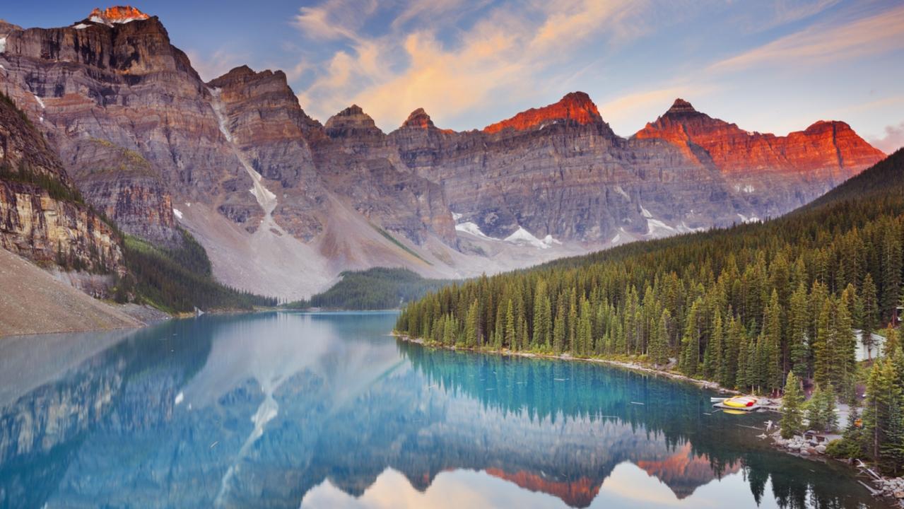
Mount Robson, Mount Assiniboine, and Hamber are BC provincial parks, not national parks. They lack visitor centers, shuttle systems, and, in most cases, paved road access. The UNESCO listing treats them as equals to the national parks in terms of landscape and geological significance, but the visitor experience is completely different.
Mount Robson is the most accessible of the three. Highway 16 runs right past the park entrance, and the visitor center sits directly off the road. The Berg Lake Trail is the park’s famous multi-day route, though it has been partially closed for repairs following major flooding, so check the BC Parks website before planning a trip. Mount Assiniboine requires either a helicopter flight, a 27-kilometer hike from the Mount Shark trailhead, or a longer approach from Sunshine Village in Banff. There is a small lodge and a campground at the core alpine area, but no roads and no services. Hamber is the most remote of all seven parks, accessible only by trail from Jasper or by float plane, and sees fewer visitors in a year than Banff sees in a single summer morning. Fortress Lake is the main draw, a massive backcountry lake with trophy trout fishing.
Why UNESCO chose these parks: criteria (vii) and (viii) explained
UNESCO inscribes World Heritage Sites under specific criteria. The Canadian Rocky Mountain Parks were listed under two: criterion (vii) for exceptional natural beauty, and criterion (viii) for representing major stages of Earth’s history, specifically the fossil record preserved in the Burgess Shale.
Criterion (vii) is the straightforward one. The contiguous mountain landscape spanning these seven parks contains an extraordinary concentration of glaciated peaks, turquoise lakes, waterfalls, and deep valleys. The Icefields Parkway alone strings together a density of superlative scenery that UNESCO’s advisory body described as unmatched in any other mountain protected area. Criterion (viii) is the scientifically significant one, and it hinges almost entirely on the Burgess Shale. These fossils, discovered in 1909 by Charles Walcott on Mount Stephen in Yoho National Park, capture the Cambrian Explosion, a relatively sudden burst of complex animal diversity roughly 508 million years ago. The shale preserves soft-bodied organisms in extraordinary detail, including ancestors of most major animal groups alive today.
UNESCO recognized the site because this one geological formation, spanning multiple of the listed parks, provides a window into a pivotal chapter of life’s history that is preserved almost nowhere else on Earth with such fidelity.
The Burgess Shale: a 508-million-year fossil discovery
The official Parks Canada page mentions the Burgess Shale in a single paragraph and states it contains roughly 150 described species. That number undersells what is actually there. Researchers have catalogued over 200 species to date, and the fossil beds continue to yield new discoveries. What makes the Burgess Shale special is not just the number of species but the preservation. Soft body parts, including gills, guts, and nervous system traces, are fossilized in fine-grained shale that formed when fine mud settled rapidly over the organisms in an ancient seabed.
Parks Canada runs guided hikes to two Burgess Shale sites in Yoho: the Walcott Quarry on Mount Stephen and the trilobite beds on Mount Field. These hikes are the only legal way to visit the fossil sites, as the locations are protected and closely monitored. The guided hikes book out months in advance. If you want to see the fossils in situ, plan your Yoho visit around a confirmed hike reservation, not the other way around. The Royal Tyrrell Museum in Drumheller, Alberta, also holds an extensive collection of Burgess Shale specimens if you want the fossil experience without the strenuous guided hike.
How the parks connect (and how to visit multiple)
The four national parks form a continuous corridor. Banff and Jasper are linked by the Icefields Parkway (Highway 93 North), a 230-kilometre route that runs past the Columbia Icefield and takes roughly three hours without stops. Yoho sits just west of Banff, accessed by the Trans-Canada Highway (Highway 1) near the town of Field, about 30 minutes from Lake Louise. Kootenay branches south from the Trans-Canada at Castle Junction, with Highway 93 South running the length of the park toward Radium Hot Springs. You can drive from Banff to Jasper, then back south through Yoho and Kootenay, in a loop of roughly 700 kilometres that touches all four national parks.
The provincial parks are more fragmented. Mount Robson lies west of Jasper on Highway 16, roughly a 90-minute drive from the Jasper townsite. Mount Assiniboine sits between Banff and Kootenay but has no road access from either. Hamber borders Jasper’s western edge but is accessible only by trail or air. A practical multi-park itinerary for a first visit covers Banff, the Icefields Parkway, and Jasper over five to seven days, with a possible day-trip detour into Yoho. Adding the provincial backcountry parks turns the trip into a serious wilderness expedition, not a road trip.
Visiting today: what has changed
The official Parks Canada page still quotes a generic “more than nine million people annually” figure, which is outdated. Combined visitation across the four national parks now routinely exceeds 10 million per year, with Banff alone receiving roughly 4 million. These numbers have real consequences for trip planning. Banff and Lake Louise now operate mandatory shuttle systems for Moraine Lake during peak season, and the Moraine Lake road is closed to private vehicles entirely. Jasper introduced timed-entry requirements for popular trailheads. Parks Canada has also implemented seasonal fire bans and trail closures with increasing frequency as wildfire seasons lengthen in western Canada.
A Parks Canada Discovery Pass costs roughly $75 CAD per adult for an annual pass covering all national parks, or about $150 CAD for a family and group pass. Single-day entry is also available but adds up fast if you are visiting multiple parks over several days. The pass is valid across Banff, Jasper, Yoho, and Kootenay. The three BC provincial parks have separate day-use or backcountry camping fees administered by BC Parks. Check the Parks Canada and BC Parks websites directly for current pricing, as fees adjust periodically.
Frequently asked questions
Is Banff or Jasper better to visit?
Neither is universally better. Banff offers more accessible iconic sights like Lake Louise and Moraine Lake, plus the convenience of a larger town. Jasper is quieter, wilder, and better for wildlife viewing and stargazing. The ideal trip visits both and uses the Icefields Parkway as the connector.
Do I need a separate park pass for each park?
No. A single Parks Canada Discovery Pass covers entry to all four national parks (Banff, Jasper, Yoho, Kootenay) for the duration of its validity. The three provincial parks (Mount Robson, Mount Assiniboine, Hamber) are managed by BC Parks and have separate, generally simpler access and camping fee structures.
Can you drive to all 7 parks?
No. Banff, Jasper, Yoho, and Kootenay are all connected by paved highways and fully accessible by car. Mount Robson is accessible by Highway 16. Mount Assiniboine has no road access and requires a helicopter flight or a multi-day hike. Hamber is accessible only by trail or float plane.
What is the best time of year to visit the Canadian Rocky Mountain Parks?
July through September offers the warmest weather and full road access, including the Icefields Parkway and high-elevation trails. Late June can still have snow at higher elevations. Late September and early October bring fall colours and fewer crowds. The Icefields Parkway remains open year-round but can close temporarily during heavy winter storms.
Why did UNESCO group these 7 parks together instead of listing them separately?
Because the mountain landscape, geology, and fossil record span all seven areas without respecting park boundaries. The Burgess Shale formation appears in both Yoho and Kootenay. The Columbia Icefield feeds rivers flowing into Banff, Jasper, and Mount Robson. UNESCO recognized the entire contiguous protected area as one interconnected site rather than seven isolated parks.
How many days do I need to see the main parks?
Five to seven days is the practical minimum for Banff, the Icefields Parkway, and Jasper with short stops in Yoho and Kootenay. A three-day weekend covers Banff and one day on the Parkway. Ten to fourteen days lets you add multi-day backcountry hikes and explore the provincial parks properly.
Are the Burgess Shale fossil beds open to the public?
Yes, but only on guided hikes led by Parks Canada authorized interpreters. The two sites in Yoho National Park, the Walcott Quarry and the Mount Stephen trilobite beds, require advance reservations that typically book out months ahead. Independent access is prohibited to protect the fossils.
Plan your trip: booking platforms we trust
For the Canadian Rockies, I book accommodation through platforms with strong cancellation policies because mountain weather shifts fast and road closures happen. For tours and shuttles, I prioritize operators with verified recent reviews mentioning guide quality and group size.
Best for hotels and lodges in Banff, Jasper, and Field with flexible cancellation terms.
Best for booking Lake Louise and Moraine Lake shuttle seats and guided Columbia Icefield tours.
Best for whole cabins and chalets near the park boundaries for families and groups.
Best for comparing flight prices into Calgary or Edmonton, the two main gateway airports.