
Hawksbill Mountain: Complete Guide to Shenandoah’s Highest Peak (3 Routes)
Fact-Checked By Maya Whitfield, Senior Travel Editor at WakaAbuja
Hawksbill Mountain is the highest point in Shenandoah National Park at 4,050 feet, and three distinct trails lead to its stone observation platform. The shortest route is a steep 1.7-mile round trip from Hawksbill Gap. A longer, more gradual approach follows the Appalachian Trail and Salamander Trail. The full Hawksbill Loop combines both for a 2.9-mile circuit with a side stop at a backcountry shelter.
The National Park Service page will give you the basic stats for the Lower Hawksbill Trail and nothing else. It will not tell you that the Salamander Trail approach delivers a quieter, more satisfying climb through a balsam fir stand that smells like the Adirondacks. It will not mention that the summit platform hangs over a 2,500-foot drop into Timber Hollow or that peregrine falcons nest on the cliffs below.
I have hiked all three routes in different seasons, made the parking mistakes, and stood on that platform in wind strong enough to knock a tripod over. This guide covers what the trailhead sign skips.
Jump to: Why It’s Worth It | VA vs. NC | 3 Routes Compared | Best Time to Hike | Planning Tips | FAQs
Key takeaways
- Hawksbill Mountain (4,050 ft) is the tallest peak in Shenandoah National Park, with a stone observation platform offering a 360-degree view of the Blue Ridge.
- Three official routes reach the summit: the steep Lower Hawksbill Trail (1.7 mi RT), the longer Salamander Trail via the AT (2.4 mi RT), and the full Hawksbill Loop (2.9 mi RT).
- Parking at Hawksbill Gap fills by 9 a.m. on autumn weekends. There is no overflow lot, and Skyline Drive offers zero shoulder parking near the trailhead.
- Shenandoah National Park charges an entrance fee. There is no additional permit or fee required to hike Hawksbill.
- The summit is one of the park’s best sunrise and sunset locations, but the trail is unlit and rocky. A headlamp is mandatory for any hike that ends after dark.
- Peregrine falcons nest on the cliffs below the summit platform. Some sections of the mountain may close temporarily during nesting season, typically spring through early summer.
Why Hawksbill Mountain is worth the climb
The summit of Hawksbill is not a narrow rocky knob where you jostle for space with twenty other hikers. It is a broad, flat clearing with a large stone observation platform built by the Civilian Conservation Corps, a sheltered bench or two, and enough room to spread out a picnic and wait for the light to change. The view stretches across the Page Valley to the Massanutten Range in the west and layers of Blue Ridge ridgelines, fading into haze, to the east.
This mountain also holds ecological significance that the Park Service trail page completely ignores. A small stand of balsam fir grows near the summit, a tree species far more common hundreds of miles north in the Adirondacks and Canada. It is a remnant of a colder climatic era, and the scent as you walk through it on the Salamander Trail approach is distinct and unexpected. Peregrine falcons, once nearly extinct in the eastern United States, nest on the cliffs below the platform and can sometimes be seen riding thermals at eye level during summer mornings.
Maya’s honest take: “This summit earns its reputation. It is not the hardest climb in the park, but the platform view feels bigger than the elevation number suggests. On a clear winter day, you can see for what feels like sixty miles.”
Is this the Hawksbill Mountain you’re looking for?
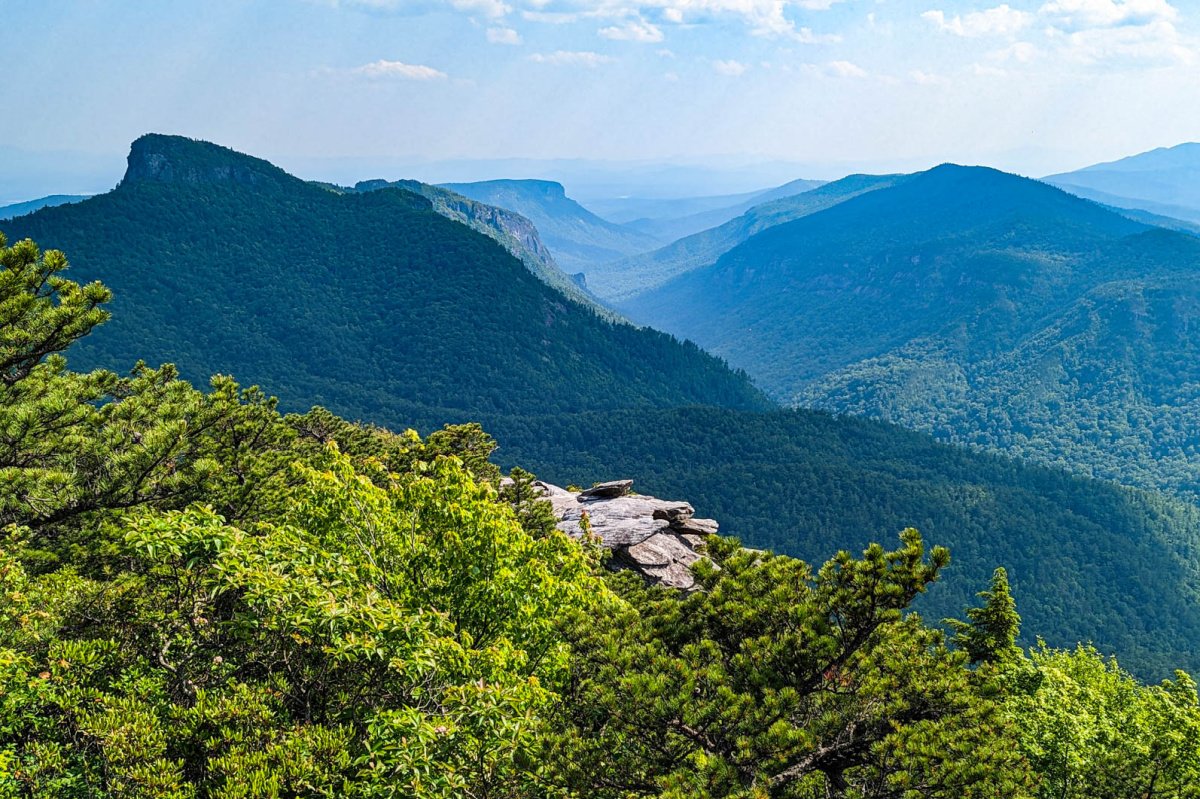
There are two well-known peaks named Hawksbill Mountain in the eastern United States. This guide covers Hawksbill Mountain in Shenandoah National Park, Virginia, the highest point in the park at 4,050 feet. If you are looking for Hawksbill Mountain in the Linville Gorge Wilderness, Pisgah National Forest, North Carolina, that is a different mountain entirely, a prominent rocky summit known for technical climbing routes and views of the Linville Gorge. The two are roughly 350 miles apart. This page covers the Shenandoah summit.
Three ways to reach the summit

All three routes start from Skyline Drive. The choice comes down to how much time you have, how steep a climb you want, and whether you prefer an out-and-back or a loop. Below is how each route actually feels underfoot, not just the numbers.
Lower Hawksbill Trail
1.7 miles round trip, 690 ft gain, moderate to strenuous. Starts from Hawksbill Gap parking area at mile 45.5 on Skyline Drive. This is the shortest and most direct route, and the one the NPS page exclusively describes. It climbs steadily through hardwood forest with few switchbacks. The grade is unrelenting but short. You will feel it in your calves. Best for a quick summit if you are short on time.
Salamander Trail via AT
2.4 miles round trip, 520 ft gain, moderate. Starts from the upper Hawksbill parking area near the Skyland Resort boundary. Follows the white-blazed Appalachian Trail briefly, then turns onto the blue-blazed Salamander Trail. This route is longer but noticeably gentler than the Lower Hawksbill grind, and it passes directly through the balsam fir stand. The forest feels older and quieter here. Best if you prefer a more gradual, meditative climb.
Hawksbill Loop
2.9 miles round trip, 690 ft gain, moderate. Combines the Lower Hawksbill Trail ascent with the Salamander Trail descent, or vice versa. This loop also passes the Byrds Nest 2 Shelter, a basic three-sided backcountry hut used by AT thru-hikers, about halfway along the Salamander leg. The loop gives you the full mountain circuit and is the best choice if you want a real hike rather than a quick summit dash.
Best time to hike Hawksbill Mountain
Hawksbill is hikeable year-round, but the experience changes drastically by season. The summit platform is fully exposed to wind, so the temperature difference between the parking lot and the top can be significant even in summer.
Sunrise and sunset
Hawksbill faces east, which makes sunrise the stronger of the two golden-hour options. The sun rises directly over the Piedmont and layers of blue ridgelines, and on a clear morning the light is spectacular. Arrive at the parking area 45 minutes before sunrise to allow time for the climb. A headlamp is mandatory. The trail is rocky and uneven, and you will be hiking in full darkness on the way up. I have done this twice now and have never had the summit to myself at sunrise, but the crowd is small and quiet, mostly photographers with tripods.
Fall foliage
Peak fall color typically hits Hawksbill during the second and third weeks of October. The summit platform offers a sweeping aerial view of the foliage below, which is the whole point. The trade-off is crowds. Hawksbill Gap parking fills by 9 a.m. on October weekends and can stay full all day. Arrive before 8 a.m., come on a weekday, or accept that you may need to park elsewhere and adjust your route to start from the upper Hawksbill lot near Skyland.
Winter conditions
The trail stays open all winter, but the Lower Hawksbill Trail in particular becomes icy and treacherous after freeze-thaw cycles. Microspikes or traction devices are strongly recommended from December through early March. The summit platform can be wind-blasted and bitterly cold. Check the Skyline Drive status before driving, because the road closes frequently during winter storms and ice events, cutting off all trailhead access entirely.
What to know before you hike
Entrance fees and passes
Shenandoah National Park charges an entrance fee. A single-vehicle pass is valid for seven days. Annual passes and America the Beautiful interagency passes are also accepted. There is no additional fee or permit required to hike Hawksbill itself, and no reservation system for this trail. Pay at the park entrance station when you enter Skyline Drive.
Parking and trailhead access
The Lower Hawksbill Trail starts from the Hawksbill Gap parking area at mile 45.5 on Skyline Drive. The lot holds roughly 20 cars and fills early on weekends and throughout October. The Salamander Trail and the loop can also be accessed from the upper Hawksbill parking area near the Skyland Resort boundary. If Hawksbill Gap is full, the upper lot is sometimes the only backup option without adding significant distance. There is no overflow parking, and Skyline Drive prohibits roadside parking outside of designated lots.
Pet policy
Dogs are permitted on all Hawksbill trails but must remain on a leash no longer than six feet at all times. The summit platform can be hot in summer and icy in winter. Bring water for your dog and check paw pads for rock abrasions after the hike.
Seasonal closures
The Park Service occasionally closes sections of Hawksbill’s cliffs during peregrine falcon nesting season, typically spring through early summer. These closures affect climbing routes on the cliffs, not the summit trails themselves, but check the official Shenandoah National Park alerts page before your visit to confirm current access status.
Common mistakes to avoid on Hawksbill Mountain
- Arriving at Hawksbill Gap after 9 a.m. on a fall Saturday. The lot will be full, and there is no plan B within walking distance. Come early or aim for a weekday.
- Underestimating the Lower Hawksbill Trail if you are out of shape. It is short, but it is genuinely steep. The NPS calls it moderate. On a hot, humid Virginia summer day, it feels harder than that rating suggests.
- Hiking without a headlamp for sunrise. The trail is not lit, the rocks are uneven, and a phone flashlight is not bright enough to navigate safely. I learned this lesson the hard way on my first sunrise attempt and nearly turned an ankle.
- Skipping traction devices in winter. The Lower Hawksbill Trail freezes into a sheet of ice in stretches. Microspikes weigh a few ounces and make the difference between a pleasant hike and a dangerous slip.
- Not bringing a wind layer. The summit platform is fully exposed. Even on a calm day at the trailhead, the wind up top can be strong and cold. Throw a jacket in your pack.
- Relying on cell service. Coverage is spotty across Shenandoah. Download offline maps and have a printed trail map or the NPS PDF saved on your phone before you leave the entrance station area.
- Expecting solitude. Hawksbill is the highest point in the park and one of the most popular hikes on Skyline Drive. You will share the summit with other people. Adjust expectations accordingly, or hike at dawn on a weekday in the off-season.
Frequently asked questions
How hard is the Hawksbill Mountain hike?
The Lower Hawksbill Trail is short but steep, gaining 690 feet in under a mile. Most hikers would call it moderate to moderately strenuous. The Salamander Trail route is longer but gentler and rates as moderate. Neither route requires technical climbing skills, and the trails are well-maintained and clearly blazed.
How long does the hike take?
The Lower Hawksbill Trail takes roughly 1 hour and 15 minutes round trip for an average hiker. The Salamander Trail route runs closer to 1 hour and 45 minutes. The full loop takes about 2 hours. Add extra time for photos at the summit, which most people do.
Can you drive to the top of Hawksbill Mountain?
No. There is no road to the summit. All routes require hiking from trailhead parking areas along Skyline Drive. The shortest walking route, the Lower Hawksbill Trail, is just under a mile each way.
Is Hawksbill Mountain the same as the one in North Carolina?
No. This Hawksbill Mountain is the highest point in Shenandoah National Park, Virginia. There is a separate Hawksbill Mountain in Linville Gorge Wilderness, Pisgah National Forest, North Carolina. The two peaks share a name but are entirely different locations roughly 350 miles apart.
Are dogs allowed on Hawksbill Mountain trails?
Yes. Dogs are permitted on all three Hawksbill routes, but they must be leashed at all times on a leash no longer than six feet. Bring water for your dog, especially in summer, as there are no reliable water sources along the trail.
What is the elevation of Hawksbill Mountain?
Hawksbill Mountain reaches 4,050 feet above sea level, making it the highest point in Shenandoah National Park. The summit features a stone observation platform built by the Civilian Conservation Corps that provides a 360-degree panorama of the Blue Ridge Mountains and the Shenandoah Valley.
Is there a fee to hike Hawksbill Mountain?
Shenandoah National Park charges an entrance fee, but there is no additional trail-specific fee or permit required to hike Hawksbill. A standard single-vehicle pass covers seven days of park access, including all trailheads along Skyline Drive.
Plan your trip: booking platforms we trust
For a Shenandoah hiking trip, I use these platforms for nearby accommodation and broader Virginia travel logistics. The park itself has limited lodging, so many visitors stay in towns along the Skyline Drive corridor.
Best for finding motels, inns, and cabins in Luray, Front Royal, and Harrisonburg near Skyline Drive entrances.
Best for renting whole cabins and mountain houses in the Shenandoah Valley for group hiking weekends.
Best for reading recent trail condition reports and restaurant recommendations in towns along Skyline Drive.
Best for bundling flights into Dulles or Charlottesville with a rental car and a Shenandoah-area hotel.