
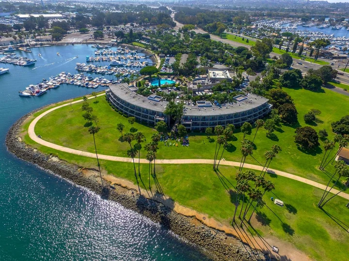
advertisement
Leisure Island is a small, man-made tidal island tucked inside Leisure Lagoon on the eastern edge of San Diego’s Mission Bay. It is only reachable on foot during low tide, and at high tide the sandbar connecting it to the shore disappears completely. This guide covers exactly where to find it, when you can walk out, and what’s actually true about the rumors you may have read online.
I first tried to visit Leisure Island on a sunny Saturday afternoon in July and found nothing but water where the path was supposed to be. A local kayaker paddling past shouted, “You’re about four hours too early!” That’s the thing about this spot: it plays hard to get. My colleague Sarah, who handles our San Diego coverage, went back at a negative low tide the following week and walked right out.
Her photos are what you’ll see below. The lesson is that timing here isn’t a suggestion; it’s the entire access plan.
Jump to: What It Is | How to Get There | Is It Safe? | What You’ll See | Nearby Spots Compared | FAQ
Key takeaways
- Leisure Island sits inside Leisure Lagoon, part of Mission Bay Park, near 2081 E Mission Bay Dr, San Diego, CA 92109.
- It is only accessible by walking across a sandbar that emerges during low tide. Check a tide chart before you go.
- The island is man-made, built as part of the mid-20th-century dredging project that created the entire Mission Bay aquatic park.
- Rumors about contamination stem from real industrial dumping in the 1950s and 60s, but the area has been remediated and is monitored by the city.
- There are no facilities on the island itself. Bring water, wear water shoes, and plan to pack out whatever you pack in.
What Is Leisure Island in San Diego?
Leisure Island is a tiny, roughly oval-shaped sand island sitting in the middle of Leisure Lagoon, a shallow swimming area on the eastern side of Mission Bay Park. It is not a natural formation. The island was created during the massive dredging operation that transformed roughly 2,000 acres of tidal marsh into Mission Bay between the late 1940s and the 1960s. Mission Bay itself is the largest man-made aquatic park in the United States, and Leisure Island is one of its quirkiest byproducts.
At high tide, the island looks like an isolated sandbar, separated from the surrounding park by a few dozen yards of knee-deep water. At low tide, a walkable strip of wet sand connects the island to the shore near the Mission Bay Resort area. The island is small enough to walk end to end in about two minutes. It has no structures, no trees, and no signage. What it does have is a strange, quiet, almost private-beach feeling, despite being surrounded by a major city.
Sarah’s field note: “Don’t confuse Leisure Island with Leisure Lagoon. The lagoon is the body of water. The island is the sandbar inside it. Google Maps labels the lagoon clearly but doesn’t mark the island at all, which is why so many people drive right past it without realizing it’s there.”
How to Get to Leisure Island and When You Can Actually Walk There
Access is straightforward once you understand the tide requirement. Park in the lot near Mission Bay Resort off East Mission Bay Drive, or use the free parking along De Anza Cove Road a short walk to the north. From the shoreline of Leisure Lagoon, look for the sandbar emerging from the water. During a low tide of one foot or lower, the path to the island is clearly visible as a raised strip of wet sand cutting through the lagoon. During a negative low tide, the walk is bone-dry in sections.
At high tide, the water over the sandbar is roughly two to three feet deep. Wading through is technically possible but not recommended: the lagoon bottom is silty and uneven, and the water can be cold outside of peak summer. The safe play is to consult a tide chart for Mission Bay before leaving the house. We use the NOAA tide predictions for the Mission Bay station and target a tide of 0.5 feet or lower for a comfortable walk. The window for crossing is typically about two hours on either side of the low-tide mark.
Parking and starting point
The closest reliable parking is the public lot at De Anza Cove Park, a five-minute walk north of Leisure Lagoon. There is also limited street parking on East Mission Bay Drive near the resort entrance. Do not park in the resort lot itself unless you are a registered guest. From the parking area, walk south along the shoreline path until you reach the lagoon’s edge. You will see the island directly ahead, roughly 100 to 150 yards offshore depending on the water level.
Best time to visit
- Weekday mornings with a low tide below 0.5 feet offer the quietest experience.
- Summer months bring warmer water for wading, but also more crowds at the lagoon shoreline.
- Negative low tides in winter can expose sandbars far beyond the island itself.
What to bring
- Water shoes or sandals with a heel strap: the sandbar is sandy but the lagoon has patches of broken shell.
- A dry bag for your phone and keys: the water depth can shift quickly as the tide comes in.
- Sunscreen and water: there is zero shade on the island.
Is Leisure Island Safe? Separating Rumor from Fact
If you have searched for Leisure Island online, you have probably seen the review calling it a “pile of poop covered sand” near an old dump site. That comment has been floating around since at least 2018, and it has spooked enough visitors that we decided to look into the actual history rather than let an anonymous review do all the talking. What we found is that there is a real, documented industrial history here. It is also decades old, and the site has been addressed.
During the 1950s and 1960s, the eastern shore of Mission Bay near what is now De Anza Cove was used as a landfill and industrial dumping site. This is not a secret or a conspiracy; it is documented in city environmental records and was the subject of a major remediation project. The site, sometimes called the De Anza Cove landfill, accepted municipal and some industrial waste before environmental regulations tightened in the 1970s. The landfill was capped, and the surrounding area has been monitored for groundwater and sediment quality ever since.
What the records actually say: The California Regional Water Quality Control Board has overseen monitoring of the former landfill site. Sediment testing in the lagoon area has been conducted periodically. As of the most recent publicly available reports, the cap remains intact, and recreational contact with the water is not restricted. The City of San Diego maintains the park area and posts any water-quality advisories at the shoreline when they occur.
What is verified vs. hearsay
Verified: there was a landfill. It was real. The area was contaminated historically. Remediation happened. Monitoring continues. Hearsay: the claim that the sand itself is toxic or that wading in the lagoon today is dangerous. We found no current public health advisory warning against recreational use of Leisure Lagoon. That does not mean swimming with your mouth open is a great idea in any urban lagoon, but it also means the online rumor has outpaced the actual regulatory record. If you want to check conditions on the day of your visit, the County of San Diego’s beach water-quality monitoring page updates advisories by location.
What You Will See When You Visit Leisure Island
At low tide, the island looks like a small desert dune dropped into the middle of a shallow bay. The sand is coarse and pale, studded with broken shells and the occasional piece of smooth sea glass. The interior of the island has a thin crust of dried salt and scattered driftwood. From the highest point, which rises maybe four feet above the waterline, you get a full-circle view of Mission Bay: the resort buildings to the south, De Anza Cove to the north, and the distant high-rises of Pacific Beach to the west.
Birds use the island heavily. Sarah counted eleven different species on her last visit, including western sandpipers, ring-billed gulls, and a single great blue heron that stood motionless on the northern tip for twenty minutes. If you are into bird photography, a low-tide morning here is worth the trip. The light at sunrise hits the water and the white sand in a way that makes the island look far more remote than it actually is. Bring a long lens and patience; the birds are used to people on the mainland side but skittish once you cross the sandbar.
One thing you will not see: facilities. No bathrooms, no benches, no trash cans. Pack out everything you bring. And keep an eye on the water level. The tide turns faster than you expect, and the sandbar you walked across will be underwater within an hour or two of low tide. Sarah sets a timer on her phone for 90 minutes after she arrives. That is her non-negotiable turnaround alarm, and it has saved her from wading back through chest-deep water twice.
Leisure Island vs. Other Mission Bay Spots: Which One Should You Visit?
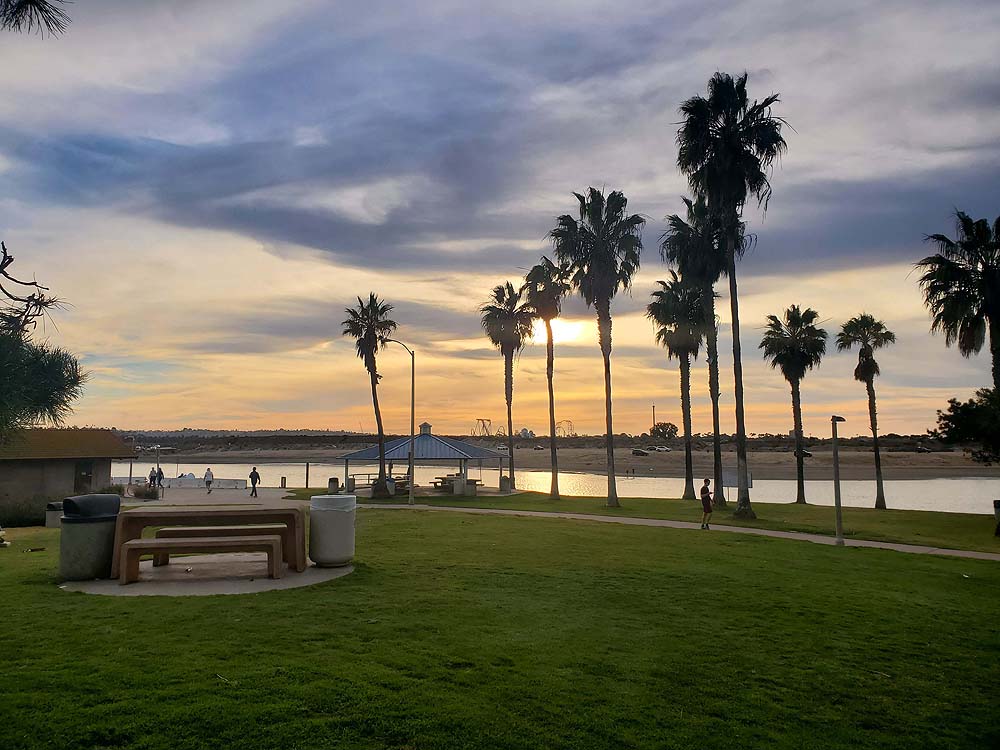
Mission Bay Park spans over 4,200 acres, and the shoreline is broken into a dozen named beaches, coves, and points. If you are deciding where to spend your afternoon, the right choice depends on what kind of experience you want. Leisure Island is for the curious and the tide-chart checkers. Fiesta Island is for dog owners and bonfire groups. Tecolote Shores is for families with young kids who need a playground and calm water.
Leisure Island
- Best for: explorers, photographers, birders, tide-pool curiosity.
- Access: tide-dependent, sandbar crossing required.
- Facilities: none on the island; restrooms at De Anza Cove lot.
- Crowd level: very low, often completely empty.
Fiesta Island
- Best for: off-leash dog beach, bonfires, kayak launches.
- Access: drive-up via Fiesta Island Road, no tide restriction.
- Facilities: portable restrooms, fire rings, wide open sand.
- Crowd level: moderate to busy on weekends.
Tecolote Shores
- Best for: families with small children, playgrounds, picnics.
- Access: direct parking off East Mission Bay Drive, paved paths.
- Facilities: playground, restrooms, picnic tables, grass areas.
- Crowd level: busy on weekends, moderate on weekdays.
How Do You Plan a Visit to Leisure Island Without Getting Stranded?
A successful visit comes down to three things: checking the tide, setting a turnaround alarm, and accepting that the trip might not happen if the tide window does not cooperate. We plan our visits around a low tide of 0.5 feet or lower, confirmed on the NOAA Mission Bay tide chart the night before. We aim to arrive 30 minutes before the low-tide mark, which gives us a comfortable hour on the island and a 30-minute buffer to walk back before the sandbar submerges.
Check the official tide prediction
The NOAA Tides and Currents station for Mission Bay provides free daily predictions. Look for “Quivira Basin, Mission Bay” or the San Diego Bay entrance station as a close proxy. Do not use a generic tide app that might be pulling data from a different station. Even a half-hour error matters when you are standing on a sandbar watching the water rise.
Pair your visit with another Mission Bay stop
Because the island itself is a short experience, we usually combine it with a walk along the De Anza Cove path or a picnic at Tecolote Shores. If the tide window is in the morning, breakfast at a Pacific Beach cafe afterward rounds out the trip well. Our internal WakaAbuja route loops the island, the cove, and a coffee stop into a two-hour outing that never feels rushed.
For more San Diego bay-front recommendations, check the City of San Diego’s official Mission Bay Park page for current advisories, parking updates, and facility maps.
What Are the Biggest Mistakes People Make at Leisure Island?
Sarah has now visited Leisure Island five times across different seasons and tide conditions. She has made the mistakes so you do not have to. Here is what trips people up.
1. Showing up at high tide and expecting to see an island. At high tide, the sandbar is underwater, and the island looks like an unremarkable sand hump offshore. Check the tide chart.
2. Wearing flip-flops. The lagoon bottom is uneven and the sandbar is shell-strewn. Flip-flops get sucked off in the mud and float away. Wear water shoes with a heel strap.
3. Not setting a return alarm. The tide rises faster than most people expect. If you lose track of time, the walk back becomes a wade through deeper, colder water.
4. Confusing Leisure Lagoon with Leisure Island. They are not the same thing. The lagoon is the water; the island is the sandbar inside it. Navigation apps do not mark the island, so you need to visually spot it from shore.
5. Ignoring water-quality advisories. While the long-term contamination narrative is largely historical, Mission Bay still gets occasional bacterial advisories after heavy rain. Check the County of San Diego beach water-quality page before wading.
Frequently asked questions
Is Leisure Island man-made?
Yes. Leisure Island was created as a byproduct of the dredging operation that built Mission Bay between the late 1940s and the 1960s. Mission Bay is the largest entirely man-made aquatic park in the United States, and the island is a sand accumulation that formed during that construction. It is not a natural barrier island or a geological feature that predates the bay’s development.
Can you swim to Leisure Island?
You can wade to it at high tide, but the water is roughly two to three feet deep and the lagoon bottom is silty and uneven. Swimming is not necessary because the distance is short and the depth is shallow. However, wading at high tide means arriving on the island already wet, and the water temperature outside of summer can be cold. Walking during low tide is the recommended approach.
Is Leisure Island the same as Leisure Lagoon?
No. Leisure Lagoon is the body of water on the eastern side of Mission Bay near the Mission Bay Resort. Leisure Island is the small sand island inside that lagoon. The two names are often conflated in online listings and reviews, which causes confusion. Google Maps labels the lagoon but does not mark the island as a separate feature.
What is the best time of day to visit Leisure Island?
The best time is whenever low tide falls during daylight hours, ideally in the morning when the light is best for photography and the crowds are thinnest. Check a tide chart for the specific day of your visit. Weekday low tides offer more solitude than weekends, when the lagoon shoreline gets busier with resort guests and local families.
Is the water at Leisure Lagoon safe for kids to wade in?
The lagoon is generally shallow and calm, which makes it popular with families, but it is an urban waterway with occasional bacterial advisories after heavy rain. Check the County of San Diego beach water-quality monitoring page for current advisories before letting children wade. Avoid swallowing lagoon water, and rinse off after contact.
Are there bathrooms or facilities on Leisure Island?
No. Leisure Island is a bare sandbar with no structures of any kind. The nearest public restrooms are at the De Anza Cove parking lot, roughly a five-minute walk north of the lagoon shoreline. Plan accordingly before you cross the sandbar, because there is no cover and no place to change on the island itself.
Plan your San Diego trip: booking platforms we trust
If Leisure Island is one stop on a larger San Diego itinerary, our team uses the following platforms to book accommodations and activities. We do not accept paid placements for these links; they are here because we have used them repeatedly with reliable results. For a Mission Bay visit, a hotel near Pacific Beach or a vacation rental with bay access puts you minutes from the lagoon.
Best for finding hotels near Mission Bay with flexible cancellation.
Ideal for bay-front vacation rentals with full kitchens and beach gear.
We check reviews here for nearby restaurants and Mission Bay activities.
Good for booking kayak rentals and Mission Bay boat tours in advance.