advertisement
Pfeiffer Beach, Big Sur, California: Current Hours, Fees & How to Find the Turnoff
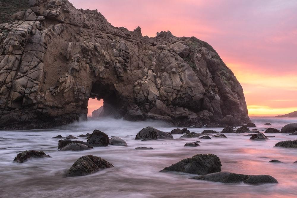
Pfeiffer Beach is a day-use area in Big Sur, California, accessed via an unmarked, single-lane road called Sycamore Canyon Road. Parking costs $15 per vehicle, cash only, and the lot fills by mid-morning in summer and on weekends. The main attractions are the Keyhole Arch rock formation, patches of purple manganese garnet sand, and winter sunsets that align directly through the arch.
Pfeiffer Beach’s turnoff has no sign, its parking lot has no overflow, and its entrance fee changes more often than most travel guides admit. Here is exactly what to expect right now: the current fee, the GPS coordinates for the turnoff you will drive past if you are not looking, and an honest explanation of when the purple sand actually shows up. I have made the drive down Sycamore Canyon Road three times across different seasons, and the logistics change more than the view does.
Jump to: Quick Facts | How to Get There | Parking & Fees | The Purple Sand | Best Time to Visit | What to Bring | Vs. Other Big Sur Stops | Safety & Rules | FAQs
Key takeaways
- The turnoff from Highway 1 is unmarked. Look for Sycamore Canyon Road between the Big Sur Ranger Station and the entrance to Pfeiffer Big Sur State Park. Use GPS coordinates 36.2385° N, 121.8120° W.
- Parking costs $15 per vehicle, cash only. There is a self-registration kiosk at the parking lot. No card payments. No digital payments. Bring exact change if possible.
- The parking lot is small and fills early. Arrive before 10 a.m. in summer and on weekends, or come after 4 p.m. for sunset. There is no overflow parking and no street parking alternative.
- The purple sand is real but patchy. It is concentrated in small pockets on the north end of the beach, not spread wall to wall. It is most visible after recent rain or wave action has exposed fresh mineral deposits.
- This is not a swimming beach. Rip currents are strong and the water is cold year-round. There are no lifeguards. Wading in the shallows is the safest approach.
- Check the road and creek status before you drive down. Sycamore Canyon Road can close after heavy rain. The seasonal creek crossing at the bottom can flood. Check the official Los Padres National Forest page for current conditions.
Quick Facts: Pfeiffer Beach at a Glance
Location & Access
- Address: Sycamore Canyon Road, Big Sur, CA 93920. The turnoff is roughly 1 mile south of the Big Sur Ranger Station on Highway 1.
- GPS coordinates for the turnoff: 36.2385° N, 121.8120° W. Save these offline before you lose signal on Highway 1.
- Road down: Sycamore Canyon Road is a narrow, winding, single-lane paved road roughly 2 miles long. Passenger vehicles handle it fine. RVs and trailers are not recommended and may not fit.
Hours & Fees
- Hours: The gate is open from roughly 8 a.m. to sunset, year-round. There is no staffed booth. The gate may be locked at sunset; do not get trapped inside.
- Parking fee: $15 per vehicle, cash only. Use the self-registration kiosk at the parking lot. No card reader. No Venmo. No ranger is making change. Bring exact bills.
- Facilities: Vault toilets are available at the parking lot. There is no running water, no snack stand, and no trash collection. Pack out everything you bring.
How to Find the Pfeiffer Beach Turnoff
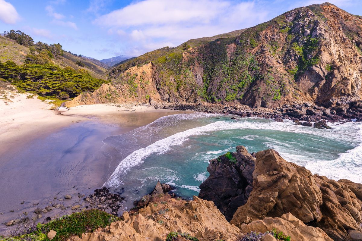
The turnoff for Pfeiffer Beach is on Sycamore Canyon Road, and there is no sign for it on Highway 1. This is not an oversight. The road is managed by the US Forest Service, and the lack of signage is deliberate to limit visitor numbers to what the small parking lot can handle. The road sits between two more famous signposted landmarks: the Big Sur Ranger Station and the entrance to Pfeiffer Big Sur State Park. Do not confuse Pfeiffer Beach with Pfeiffer Big Sur State Park.
They are different places, run by different agencies, with different parking lots, and the state park entrance has a large sign you will see. The beach access road does not.
Driving South from Monterey/Carmel
Drive south on Highway 1 past the Big Sur River Inn, the Big Sur Ranger Station, and the entrance to Pfeiffer Big Sur State Park. The unmarked Sycamore Canyon Road is on your right, roughly 1 mile after the ranger station. If you reach the Big Sur Lodge or the signposted entrance to the state park campground, you have gone too far. Turn around at the next safe pullout and look for the narrow road on the ocean side.
Driving north from San Simeon/Cambria
Drive north on Highway 1 past the Esalen Institute and the town of Lucia. The road to Pfeiffer Beach is on your left, roughly 10 miles north of the Nepenthe restaurant. Look for a break in the trees and a narrow road descending on the ocean side. If you pass the entrance to Pfeiffer Big Sur State Park or the Big Sur Ranger Station, you have missed it. Turn around at the ranger station and head back south.
What If the Road Is Flooded or Closed?
Sycamore Canyon Road crosses a seasonal creek near the bottom. After heavy winter rain, the creek can flood the road, and the gate at the top may be locked. There is no live online status indicator for the gate. The most reliable way to check current conditions is to call the Big Sur Ranger Station directly or check the official Los Padres National Forest Monterey Ranger District page before you drive out. Do not attempt to drive through standing water across the road. The road is narrow with no pullouts, and turning around mid-descent with oncoming traffic is difficult and dangerous.
Is There a Shuttle Option?
A seasonal shuttle from the Big Sur Station to Pfeiffer Beach has operated intermittently in past summers. Availability is not guaranteed year to year. Check with the Big Sur Ranger Station or the official Los Padres National Forest website for the current season’s shuttle schedule. If a shuttle is running, it solves the parking problem entirely and is worth the fare. If no shuttle is operating, driving is the only option.
Parking & Fees: The Current Reality
The parking lot at the bottom of Sycamore Canyon Road holds roughly 60 vehicles. On summer weekends and during holiday periods, it fills by 10 a.m. There is no overflow lot, no street parking on the narrow canyon road, and no alternative parking within walking distance. When the lot is full, you will be turned around at the gate at the top of the road. The strategy that works is straightforward: arrive before 9 a.m. to guarantee a spot, or arrive after 4 p.m. when the morning crowd has started to leave and the sunset crowd has not yet filled the lot. Midweek visits outside of summer are far more forgiving.
The parking fee is $15 per vehicle, cash only. There is a self-registration kiosk at the lot. You take an envelope, fill in your license plate number, insert cash, and drop the envelope into the locked box. Display the tear-off stub on your dashboard. There is no card reader, no digital payment option, and no ranger on duty making change. Bring exact bills. An America the Beautiful National Parks Pass does not cover this fee because the beach is managed by the US Forest Service, not the National Park Service.
Maya’s honest take: “I arrived at 11 a.m. on a Saturday in June and was turned away at the gate. I drove back at 4:30 p.m. the same day, got a spot, and had one of the best sunsets of my life. The timing strategy is not a suggestion. It is the difference between seeing the beach and seeing a closed gate.”
The Purple Sand: What to Realistically Expect
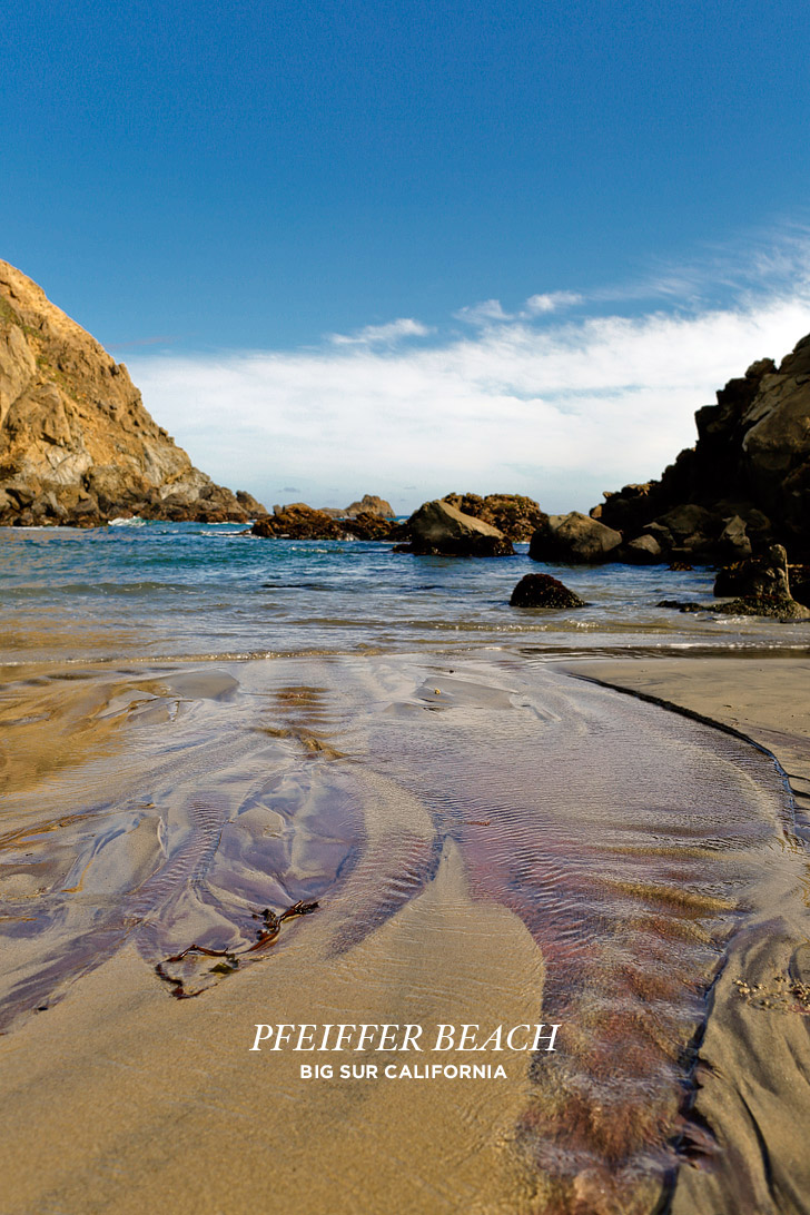
The purple color on Pfeiffer Beach comes from manganese garnet deposits eroding out of the surrounding hillsides and washing down to the shore. The garnet grains are heavier than the surrounding quartz sand, so wave action concentrates them into visible bands and swirls, particularly on the north end of the beach. The purple is real, but it is not a wall of violet sand stretching the length of the shore. It appears in patches, often faint, and its visibility depends on recent weather. The best conditions for seeing distinct purple sand are after a storm or heavy rain that has exposed fresh mineral deposits; at low tide when more of the beach is exposed; and in direct sunlight, which brings out the color more than overcast conditions.
If you visit on a cloudy day at high tide after a dry spell, you may see almost no purple at all. Adjust your expectations accordingly and treat the purple sand as a bonus, not the main event. The Keyhole Arch, the rugged cliffs, and the empty shoreline are worth the drive regardless.
Best Time to Visit Pfeiffer Beach
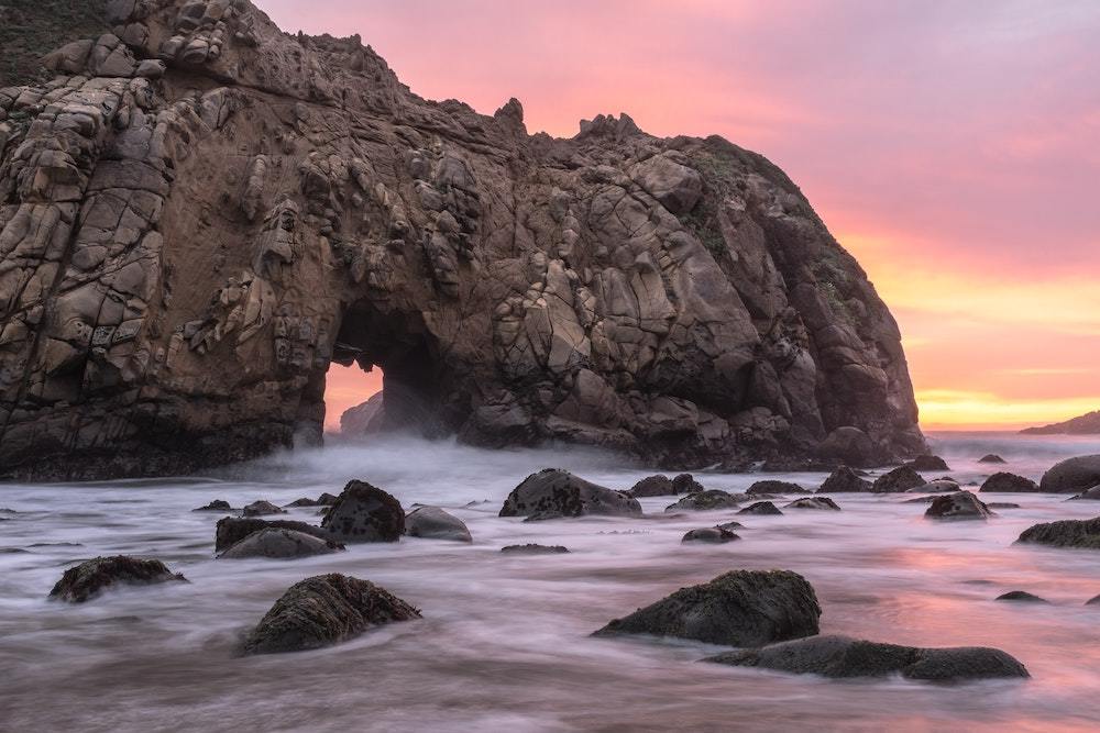
The beach works across all seasons, but the experience shifts. Sunset is the best time of day year-round, with the setting sun dropping toward the horizon behind Keyhole Arch. The winter solstice window, roughly late December through early January, is when the sunset aligns directly through the arch opening, creating a shaft of golden light that photographers travel across the world to capture. This is also the busiest single stretch of the year at the beach. Arrive hours before sunset during the solstice window, or accept that you will likely be turned away at the gate. For general beach-going without the solstice crowds, spring and autumn weekdays offer the best balance of decent weather and manageable parking. Summer is reliably sunny but crowded. Winter is dramatic and empty, but the road and creek crossing may be closed after rain.
Check the tide table before you go. Low tide exposes more beach, more sand, and more tide pools near the rocks. High tide leaves a narrower strip of sand and can make the north end of the beach inaccessible.
What to Bring to Pfeiffer Beach
There are no services at the beach. Bring everything you need and take everything back with you. This is not a resort beach with a snack bar and a rental umbrella stand. It is a wild stretch of coast with a vault toilet and a parking lot.
Essentials
- Water, at least 1 litre per person. There is no potable water source.
- Snacks or a packed lunch. The nearest food is back on Highway 1.
- Sun protection, hat, sunglasses, sunscreen. There is minimal shade.
- Layers and a windbreaker. The wind off the Pacific is cold even on sunny days.
- Cash for the $15 parking fee. Exact bills if possible.
Nice to Have
- Water shoes or sturdy sandals. The sand can be coarse, and the rocks near the arch are sharp.
- A camera and a tripod if you are shooting the sunset or the solstice light beam.
- Binoculars for spotting whales and sea otters offshore during migration season.
- A trash bag. There are no bins. Pack out everything.
- A flashlight or headlamp if you are staying until sunset. The walk back to the car is dark.
Pfeiffer Beach vs. Other Big Sur Stops
Big Sur packs multiple famous stops into a short stretch of Highway 1. If you have limited time, here is how Pfeiffer Beach compares to the neighbours so you can decide where to spend your hours.
Pfeiffer Beach
Time needed: 1.5 to 3 hours. Fee: $15 cash. Difficulty: Easy, short walk from the parking lot. Best for: Sunset photography, purple sand, solitude on weekdays, winter solstice light beam.
McWay Falls (Julia Pfeiffer Burns State Park)
Time needed: 30 to 60 minutes. Fee: $10 state park day-use fee. Difficulty: Easy, short paved trail to the overlook. No beach access. Best for: The iconic waterfall-onto-sand photograph, quick stops, accessibility.
Garrapata State Park
Time needed: 1 to 2 hours. Fee: Free. Difficulty: Moderate, trails along the bluffs and down to the beach. Best for: Wildflower blooms in spring, fewer crowds, free access, dramatic coastal hiking.
Bixby Creek Bridge
Time needed: 15 to 30 minutes. Fee: Free. Difficulty: Easy, roadside pullout. Best for: The classic Big Sur bridge photograph, quick stops, sunrise light on the bridge arches.
Safety & Rules at Pfeiffer Beach
Pfeiffer Beach is beautiful and unsupervised. The same isolation that makes it special also means you are responsible for your own safety.
- Do not swim. Rip currents are strong, the water is cold, and there are no lifeguards. Wading in the shallows is the safer option, and even that requires watching the waves. Sneaker waves can surge further up the beach than expected.
- Keep dogs on a leash. Dogs are allowed on the beach but must be leashed. There is no off-leash area. Pick up after your dog and carry the waste out.
- Weddings and commercial photography require a permit. The US Forest Service manages Pfeiffer Beach and requires a special-use permit for weddings, elopements, and commercial photo or video shoots. Permits are generally not issued between mid-March and mid-October due to high visitation. If you are planning a Big Sur elopement, contact the Monterey Ranger District directly well in advance and have a backup plan.
- Watch the tide and the cliffs. The beach narrows at high tide, and sections can become cut off. Do not climb on the unstable cliffs above the beach. Rockfalls are common along this stretch of coast.
- Check the road and gate status before you commit to the drive. The access road and gate status can change after rain. Call the Big Sur Ranger Station or check the official Los Padres National Forest website for current conditions before you set out.
Frequently asked questions about Pfeiffer Beach, California
How much does it cost to park at Pfeiffer Beach?
Parking costs $15 per vehicle, cash only. There is a self-registration kiosk at the parking lot. No card payments are accepted. Bring exact bills if possible. An America the Beautiful National Parks Pass does not cover this fee.
Is there cell signal at Pfeiffer Beach?
Cell signal is unreliable at best. Most carriers have weak or no service in the canyon and on the beach itself. Download offline maps, save the GPS coordinates for the turnoff, and bring cash before you leave Highway 1. Assume you will have no data once you turn onto Sycamore Canyon Road.
When is the purple sand visible at Pfeiffer Beach?
The purple sand is most visible after recent rain or wave action that has exposed fresh manganese garnet deposits. It appears in patches on the north end of the beach, best seen at low tide in direct sunlight. On a cloudy day at high tide, the purple may be barely visible. Treat it as a bonus, not a guarantee.
Can I take the shuttle to Pfeiffer Beach instead of driving?
A seasonal shuttle from the Big Sur Station to Pfeiffer Beach has operated in some past summers, but availability is not guaranteed year to year. Check with the Big Sur Ranger Station or the official Los Padres National Forest website for the current season’s schedule before relying on this option.
Are weddings or photoshoots allowed at Pfeiffer Beach?
Weddings, elopements, and commercial photography require a special-use permit from the US Forest Service. Permits are generally not issued between mid-March and mid-October due to high visitation. Contact the Monterey Ranger District directly for current permit requirements and availability.
Is Pfeiffer Beach the same as Pfeiffer Big Sur State Park?
No. They are different places managed by different agencies. Pfeiffer Beach is managed by the US Forest Service and accessed via Sycamore Canyon Road. Pfeiffer Big Sur State Park is a separate inland park with a campground, lodge, and river access, managed by California State Parks. The state park has a large sign on Highway 1. The beach access road does not.
What time does the Pfeiffer Beach gate close?
The gate at the top of Sycamore Canyon Road is locked at sunset. The exact time varies by season. Check the posted time at the gate when you enter, and leave the parking lot before sunset to avoid being locked in. There is no overnight parking or camping.
Plan your Big Sur trip: resources we use
We do not process bookings for Pfeiffer Beach itself, which requires no reservation. For accommodation and trip planning in the Big Sur area, these are the platforms we use.
Best for finding Big Sur lodges, cabins, and Monterey-area hotels near the Highway 1 corridor.
Best for booking guided Big Sur and Highway 1 road trip tours that include Pfeiffer Beach as a stop.
Best for reading recent traveller reviews of Pfeiffer Beach conditions before you set out.