A trip to Great Smoky Mountains National Park now requires a parking tag for any stop longer than 15 minutes, demands early arrival at popular trailheads like Alum Cave and Laurel Falls to secure a spot, and rewards visitors who understand that fall foliage arrives at high elevations first in mid-October before reaching the valleys weeks later.
I drove into Cades Cove at 10 a.m. on a crisp October Saturday, confident I had planned perfectly. I spent the next 45 minutes in a line of idling cars, staring at the same patch of meadow. Fatima, who visited the park’s North Carolina side a month later, made a different mistake: she hiked to Clingmans Dome without downloading an offline map and emerged from the fog completely disoriented with zero cell signal.
The Smokies are the most visited national park in the United States, drawing over 12 million people annually, yet the official National Park Service page is essentially a directory of area names with no practical advice on how to actually navigate the experience. This guide fills every gap the official sources leave wide open.
Jump to: Parking Tag System | Crowd-Beating Strategy | Firefly Season | Fall Foliage Timing | Campsite Booking | Budget Breakdown | Gateway Towns Compared | Wildlife Calendar | Accessibility Guide | Cell Service & Maps | FAQ
Key takeaways
- A parking tag is mandatory for any vehicle stopped longer than 15 minutes inside the park; purchase it online before you arrive, not at the entrance.
- Arrive at Cades Cove, Alum Cave trailhead, and Clingmans Dome before 8 a.m. in peak season, or expect to circle for parking or sit in a miles-long backup.
- Synchronous firefly viewing in Elkmont requires winning a timed lottery entry; applications open in late April and fill instantly.
- Fall foliage moves downhill: high elevations like Clingmans Dome peak in early to mid-October, while valley floors and Cades Cove peak in late October to early November.
- Gatlinburg puts you closest to the park’s northern entrances but buries you in tourist traffic; Townsend offers the quietest access to Cades Cove.
Do I need a parking tag to visit Great Smoky Mountains National Park?
Yes. As of this year, every vehicle parked anywhere inside the park boundary for more than 15 minutes must display a valid parking tag. This applies to every trailhead, overlook, visitor center, and picnic area. You cannot buy the tag at every pull-off; you purchase it online through the official Great Smoky Mountains National Park parking tag portal or at specific in-person kiosks at Sugarlands and Oconaluftee visitor centers. Do not count on the kiosk being functional. I watched three people at Sugarlands stare at a frozen touchscreen for ten minutes before giving up.
The tags come in three durations: daily, weekly, and annual. As of early this year, a daily tag costs $5, a weekly tag costs $15, and an annual tag runs $40. The weekly and annual tags are physical hangtags shipped to your address, so order them at least two weeks before your trip. The daily tag is a digital pass you can show on your phone, but remember that cell service is nonexistent in most of the park. Screenshot it or print a paper copy before you leave your lodging. The tag requirement applies to every passenger vehicle; oversized vehicles and RVs follow the same rules. The revenue directly funds park maintenance and staffing, which matters when you are sitting in a traffic jam hoping a ranger shows up to direct cars.
Chidi’s honest take: “I ordered the annual tag even though I only planned a five-day trip. It cost $40 instead of $15, but the peace of mind that I wouldn’t have to mess with a daily digital tag in zero-signal zones was worth the extra $25. If you come back even once, it pays for itself.”
How do I beat the crowds at the most popular Smoky Mountain trailheads?
The Smokies receive more visitors than any other national park, and the majority funnel into a handful of iconic spots. Timing is everything. For Alum Cave Trail, the primary route to Mount LeConte, the parking lot fills by 7:30 a.m. on summer weekends. Arrive by 6:45 a.m., and you will walk straight to the trailhead. Arrive at 9 a.m., and you will park a mile down Newfound Gap Road and walk a narrow roadside shoulder with logging trucks roaring past. I learned that the hard way and spent the first twenty minutes of my hike genuinely rattled by the traffic.
Laurel Falls Trail, the most popular waterfall hike in the park, has a small paved lot that overflows by 9 a.m. daily from June through October. The pavement on the trail itself draws families and casual hikers, which means the bottleneck starts at the parking lot, not the trail. Come at sunrise or after 4 p.m., when the early crowd has cleared out and the light is better for photography anyway. Clingmans Dome, the highest point in the park, fills its parking lot by 10 a.m. in summer and fall. The observation tower at the summit is a concrete spiral ramp with a 360-degree view; arriving before 8 a.m. gives you the ramp to yourself and the misty mountain panorama without forty strangers in your frame.
Cades Cove Loop Road is its own category of traffic. The 11-mile one-way loop backs up for hours on weekends and during fall foliage season. On a peak October Saturday, the loop can take three hours to drive. Arrive at the gate before sunrise on Wednesdays, when the road is closed to vehicles until 10 a.m. and open only to cyclists and pedestrians. If you must drive the loop on a weekend, enter by 7 a.m. or after 5 p.m. The light is better in the late afternoon anyway, slanting through the meadows and lighting up the deer that graze near the tree lines.
How do I see the synchronous fireflies in the Smokies?
The synchronous firefly event near Elkmont Campground is one of the most extraordinary natural displays in North America. For roughly two weeks each year, usually in late May to early June, thousands of Photinus carolinus fireflies flash in unison, creating waves of light that ripple through the dark forest. The exact dates shift each year based on temperature and soil moisture. The park announces the official viewing window in late April through its website and social media channels.
This is not a show-and-go event. The National Park Service runs a timed lottery system for vehicle passes to park at Sugarlands Visitor Center, where a shuttle takes you to Elkmont. The lottery application window opens for a single 48-hour period, typically in late April. You submit your preferred dates and the number of people in your vehicle. Results are emailed within a week. If you win, you pay a small reservation fee and receive a specific shuttle time. Do not attempt to drive yourself to Elkmont during the event; the road is closed to unauthorized vehicles. Unauthorized parking results in a citation and tow.
If you miss the lottery, you have one alternative: book a campsite at Elkmont Campground for the event dates. Campsite reservations open six months in advance and sell out within minutes for the firefly window. This is the high-effort, high-reward backup plan. The walk-in viewing area from the campground does not require a shuttle pass. Bring a chair, a red flashlight only, and arrive at the viewing area by 7:30 p.m. to sit quietly until full dark. The fireflies begin flashing around 9:30 p.m. and continue for roughly two hours. No white lights, no flash photography, no insect repellent sprayed on-site. The rangers enforce all of this strictly, and for good reason: white light disrupts the fireflies’ mating signals and ruins the experience for everyone within a hundred yards.
Fatima’s honest take: “I lost the lottery two years in a row. The third year, I booked an Elkmont campsite the moment reservations opened and finally saw it. Sitting in the dark with a hundred strangers in complete silence, watching the forest pulse with cold light, was worth every failed lottery attempt. Bring a camp chair with a cup holder. You’ll be sitting still for a long time.”
When is the best time to see fall foliage in the Great Smoky Mountains?
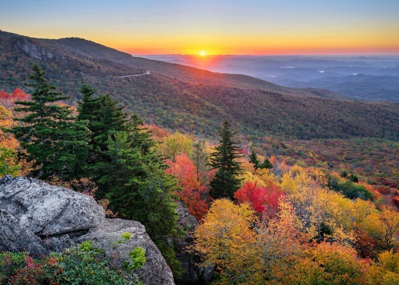
Most guides say “October” and leave it there. The Smokies span over 5,000 feet of elevation change, which means autumn arrives in waves. At the highest elevations, above 5,000 feet along Clingmans Dome Road and Newfound Gap, the hardwoods turn first. Peak color here typically lands in the first two weeks of October. The air is crisp, the crowds are still manageable, and the views from the Clingmans Dome tower stretch across a carpet of red and gold.
Mid-elevation areas like the Roaring Fork Motor Nature Trail and the upper sections of the Blue Ridge Parkway hit peak in mid-October. This is when the park feels busiest, and the traffic jams begin in earnest. By late October into the first week of November, the lower valleys, Cades Cove, and the Townsend entrance corridor reach their full color. The sugar maples in Cades Cove blaze orange against the green meadow grass, and the crowds have thinned slightly compared to the mid-October crush. If you can only visit on a single weekend and want the broadest color coverage, target the third weekend of October. You will share the park with thousands of other leaf-peepers, but the show is at its absolute maximum.
How do I actually get a campsite reservation in the Smokies?
Frontcountry campsite reservations for Elkmont, Cades Cove, Cosby, and Smokemont open on a rolling six-month window through Recreation.gov. For a July 4 weekend site, you log in at exactly 10 a.m. Eastern Time in early January and compete with thousands of other people clicking the same button. The prime loops at Elkmont, the ones along the Little River, disappear within 60 seconds. Create your Recreation.gov account in advance, log in ten minutes early, have your payment method saved, and know exactly which loop and site numbers you want. Do not browse. Click, reserve, and confirm.
If you miss the six-month window, cancellations do happen, especially in the two weeks before a given date as people’s plans shift. Check Recreation.gov daily in the morning. The park also maintains a handful of first-come, first-served campgrounds: Cataloochee, Big Creek, and Balsam Mountain. These are remote, have no cell service, and require driving winding gravel roads to reach, but they almost never fill completely. Arrive on a weekday morning for the best chance. For backpackers, backcountry sites require a separate permit and reservation through the park’s backcountry office. The shelters along the Appalachian Trail fill on a different schedule and are a topic for a dedicated Smoky Mountain backpacking guide.
How much does a trip to the Great Smoky Mountains cost?
The Smokies remain one of the most affordable national parks because there is no entrance fee. You pay for parking, lodging, food, and whatever activities you book outside the park boundary. A weekly parking tag costs $15. A frontcountry campsite runs $25 to $36 per night depending on the campground. A budget-conscious couple sleeping in a tent and cooking their own meals can spend under $60 a day total inside the park. That is vanishingly rare in American national park travel.
Cabin rentals in Gatlinburg and Pigeon Forge vary wildly. A basic one-bedroom cabin ten minutes from a park entrance rents for $120 to $180 per night in summer. A luxury cabin with a hot tub and mountain view easily hits $350 to $500 per night. Book cabins through Vrbo or Booking.com and filter carefully for genuine proximity to a park entrance, not just a vague “mountain view” claim. Hotel rooms in Gatlinburg along the Parkway run $100 to $200 per night. Townsend and Cherokee are consistently cheaper, with motel rooms from $70 to $120 per night. Dining in Gatlinburg is tourist-priced; a sit-down dinner for two easily runs $50 to $80. Packing picnic lunches from a grocery store in Pigeon Forge or Cherokee saves $20 to $30 per person per day. Gas stations inside the park are nonexistent; fill your tank in the gateway town before you enter.
Which gateway town should I stay in: Gatlinburg, Pigeon Forge, Townsend, or Cherokee?
Gatlinburg is the closest town to the park’s main northern entrances. You can walk from downtown Gatlinburg to the Sugarlands Visitor Center trailhead in under twenty minutes. The tradeoff is traffic, noise, and a main street that feels like a permanent carnival. If you want to maximize park time and do not mind crowds after dark, Gatlinburg is the most convenient base. Book a hotel off the main Parkway to reduce noise. Use Hotels.com to filter for properties on River Road rather than the Parkway itself.
Pigeon Forge sits farther north, fifteen to twenty minutes from the park entrance in no traffic, and up to an hour in peak season. It is the family entertainment hub, home to Dollywood, dinner theaters, and outlet malls. The lodging is slightly cheaper than Gatlinburg, but you sacrifice park proximity for family activities. Townsend is the quiet side. It lies on the park’s western edge, gives you the fastest access to Cades Cove, and has almost no commercial development. This is where you stay if you want peace and quiet and do not mind driving thirty minutes for a restaurant that is not a pancake house. The cabins and motels here are the cheapest of the four towns.
Cherokee is the primary gateway on the North Carolina side. It sits just outside the Oconaluftee entrance and the Blue Ridge Parkway terminus. Cherokee has a strong cultural presence from the Eastern Band of Cherokee Indians, a casino resort for those who want that, and the quietest southern access to the park’s deep trails and the Cataloochee elk herds. Lodging in Cherokee and the nearby town of Bryson City is generally more affordable than Gatlinburg. Choose Cherokee if you plan to explore the North Carolina side, the Blue Ridge Parkway, or Cataloochee Valley.
@mountainmamacabins Replying to @shmmevv tbh I’m not sure which one I like better, now that I’ve gotten older! #smokymountains #pigeonforge #gatlinburg
Choose Gatlinburg if…
- You want to walk into the park from your hotel.
- You plan to hike Alum Cave, Chimney Tops, or Rainbow Falls.
- You do not mind noise and tourist crowds after dark.
Choose Townsend if…
- Cades Cove is your priority.
- You want quiet lodging and dark night skies.
- You prefer cooking your own meals over restaurant dining.
Choose Cherokee if…
- You want to see elk and explore Cataloochee.
- The Blue Ridge Parkway is part of your plan.
- You want lower lodging costs on the North Carolina side.
What wildlife can I see in the Smokies, and when is the best time?
Black bears dominate the conversation, and the Smokies harbor roughly 1,900 of them. Cades Cove and the Roaring Fork Motor Nature Trail are the most reliable bear-viewing areas, especially in the early morning and late evening from late spring through early fall. Open meadows with berry patches are your best bet. Stay inside your vehicle if a bear is near the road. Rangers issue citations for approaching bears, and habituated bears get euthanized. A 150-foot minimum distance is not a suggestion.
Elk are the park’s other megafauna highlight, reintroduced to Cataloochee Valley in 2001. The best elk viewing happens at dawn and dusk in Cataloochee during the fall rut, roughly September through October, when bulls bugle across the meadows. Arrive before sunrise and stand quietly near the Cataloochee Ranger Station. The bugle is a high-pitched whistle that echoes off the valley walls; hearing it in the cold morning air is one of the park’s most haunting experiences.
The Smokies are also the salamander capital of the world, with over thirty species living in the park’s creeks and moist forest floors. Streamside trails like the Middle Prong Trail in Tremont or the Porters Creek Trail near Greenbrier offer easy opportunities to spot them. Wild turkeys strut through Cades Cove meadows year-round. Raptors, including red-tailed hawks and peregrine falcons, ride thermals along the ridges in spring and fall migration. The synchronized firefly show is the park’s most famous insect event, but the fall monarch butterfly migration passes through Cades Cove in late September and early October.
@brandilynn230 If you’re wanting to enjoy the warmth or a popular time in the smokies, these are the best times to come! Let me know when you like to visit down below! #gatlinburg #thingstodoingatlinburg #pigeonforge #smokymountains #greatsmokymountainsnationalpark
Is Great Smoky Mountains National Park accessible for visitors with mobility challenges?
The Sugarlands Valley Nature Trail, located just south of Sugarlands Visitor Center, is a fully paved, wheelchair-accessible loop with interpretive signs and quiet forest views. It is short, level, and the only trail in the park specifically designed for full accessibility. Mingus Mill, near the Oconaluftee entrance, is a historic grist mill with accessible parking and a paved path to the mill structure, though the interior has a raised threshold.
Several scenic drives require no walking whatsoever. Newfound Gap Road crosses the park from Gatlinburg to Cherokee and offers dozens of pull-offs with mountain views, including the Newfound Gap overlook itself. Clingmans Dome Road ends at a parking lot; the observation tower at the summit is reached by a steep, half-mile paved path that is too steep for unassisted wheelchair use. The Cades Cove Loop Road, the Roaring Fork Motor Nature Trail, and the Cataloochee entrance road are all driveable with frequent pull-offs. Accessible picnic areas exist at Collins Creek, Deep Creek, and Metcalf Bottoms. The Sugarlands and Oconaluftee visitor centers are fully accessible with accessible restrooms.
Is there cell phone service in the Great Smoky Mountains?
Assume zero cell service inside the park boundaries. A few high-elevation pull-offs, including Newfound Gap and Clingmans Dome parking lot, sometimes catch a weak signal from distant towers in Gatlinburg or Cherokee, but you cannot rely on it. Download offline maps before you enter. The NPS app has a downloadable park map. AllTrails and Maps. I allow you to save trail maps for offline use. I keep a screenshot of my parking tag QR code, a downloaded map, and a paper park map from the visitor center as triple redundancy.
WiFi is available at the Sugarlands and Oconaluftee visitor centers, but the signal is slow and shared with hundreds of other visitors. Do not plan a video call. The nearest reliable ATM is in Gatlinburg, Pigeon Forge, Townsend, or Cherokee. There is no ATM anywhere inside the park. Bring cash for small purchases at the Cades Cove camp store or the farmstead gift shops. If you need to reach someone in an emergency, the park’s emergency number is posted at trailheads and visitor centers. Rangers carry radios; your cell phone is not a reliable emergency tool once you leave the gateway towns.
Chidi’s honest take: “I drove Newfound Gap Road assuming my phone’s GPS would hold. It dropped signal three miles south of Sugarlands and never came back until I reached Cherokee. Now I treat offline maps as non-negotiable. The paper map from the visitor center is also excellent and free. Grab one even if you think you won’t need it.”
Where are the best photography spots in the Smoky Mountains?
Morton Overlook on Newfound Gap Road is the classic misty sunrise shot. Arrive forty-five minutes before sunrise to claim a spot on the stone wall. On a clear morning, the valley fills with fog, and the mountains stack in blue, receding layers. Cades Cove at golden hour, roughly one hour before sunset, lights the meadow grasses amber and draws deer out to graze near the treeline. The Tipton Place and Carter Shields’ cabin are the most photogenic historic structures on the loop.
Grotto Falls on the Trillium Gap Trail is the only waterfall in the park you can walk behind. Afternoon light filters through the water curtain. A wide-angle lens works best here; the trail behind the falls is narrow, and the spray is constant. Laurel Falls photographs best in late afternoon when the sun slants through the gorge. The paved trail is busy, but framing the upper cascade with foreground rhododendron leaves gives you a shot that looks far more remote than it is.
For firefly photography, a tripod, a wide aperture lens set to f/1.4 or f/2.8, a remote shutter release, and a series of 30-second exposures stacked in post-processing are the standard formula. Red headlamp only. No flash, ever. The rangers will eject you if you pop a white flash during the firefly display.
What mistakes do first-time visitors to the Smokies make?
Arriving without a parking tag. The tag requirement is new and well-enforced. Rangers check windshields at trailheads and issue citations. Buy it online before you leave home.
Trusting GPS inside the park. Google Maps and Apple Maps lose signal and often route you down closed seasonal roads or gravel tracks that dead-end at a locked gate. Use a paper map or a pre-downloaded offline map as your primary navigation tool.
Underestimating drive times. Newfound Gap Road from Gatlinburg to Cherokee takes at least an hour without traffic. With fall foliage traffic, it takes two. The park is larger than it looks on a map; the speed limits are low, and the overlook pull-offs are frequent and tempting.
Skipping the visitor center. The Sugarlands and Oconaluftee visitor centers have rangers who know current trail conditions, bear activity reports, and road closures. A two-minute conversation can save you an hour of wasted driving. I skipped Sugarlands on my first trip and drove straight to a trailhead that had been closed for a bear encounter all morning.
Leaving food in your car at trailheads. Bears in the Smokies know what coolers and grocery bags look like. They break into cars. The park posts signs at every trailhead warning you, and rangers will cite you for leaving visible food. Lock it in a bear-proof container or leave it at your lodging.
Expecting a quick drive through Cades Cove on a fall Saturday. The loop backs up for miles. Go before 7 a.m. or after 5 p.m., or choose a weekday. On Wednesday and Saturday mornings from May through September, the road is vehicle-free until 10 a.m., reserved for cyclists and pedestrians only.
Not checking the air quality forecast. The Smokies suffer from significant air pollution, and on bad ozone days the panoramic views disappear into haze. The NPS posts a daily air quality index on its website. A hazy day at Clingmans Dome reduces visibility from 100 miles to under 10.
Frequently asked questions
Do I need a reservation to enter Great Smoky Mountains National Park?
No entrance reservation is required. You do need a parking tag for any stop longer than 15 minutes, purchased online in advance. The park has no entrance gate and no entrance fee.
How many days do I need in the Great Smoky Mountains?
Three full days covers the greatest hits: one day for Cades Cove and the western side, one day for Newfound Gap Road and the central highlands, and one day for the North Carolina side, including Cataloochee and the Blue Ridge Parkway. Add a fourth day for deeper hiking or firefly viewing.
When are the synchronous fireflies in the Smokies?
The event typically runs for two weeks from late May to early June. Exact dates are announced by the park in late April. A timed lottery for shuttle passes opens for a 48-hour window, also in late April.
Are there bears in the Great Smoky Mountains?
Yes, approximately 1,900 black bears live in the park. Cades Cove, Roaring Fork, and Cataloochee are the most reliable viewing areas, especially at dawn and dusk in summer and early fall. Maintain at least 150 feet of distance and never feed or approach a bear.
What is the best month to visit the Smoky Mountains?
October offers peak fall foliage, but mid-October is the busiest window. Late September delivers pleasant temperatures, reduced crowds, and the start of the elk rut. Late May brings the fireflies and full summer greenery before the heaviest tourist crush.
Is Cades Cove worth the traffic?
Yes, for the wildlife viewing, historic cabins, and mountain meadow scenery. The key is timing. Go at dawn on a Wednesday or Saturday morning during the vehicle-free window, or arrive after 5 p.m. on any weekday. Saturday afternoon in October is the worst possible time.
Plan your trip: booking platforms we trust
The WakaAbuja team relies on these platforms for Smoky Mountain trips because they offer verified reviews, flexible cancellation options, and the ability to filter lodging by genuine proximity to park entrances rather than vague marketing claims.