advertisement
Shenandoah River Guide: Where to Paddle, Fish & Tube
Fact-Checked By Maya Whitfield, Senior Travel Editor at WakaAbuja
Quick answer:
The Shenandoah River is a 55.6-mile main-stem river formed by the confluence of the North Fork and South Fork near Front Royal, Virginia, before flowing north to the Potomac at Harpers Ferry. It is one of the most accessible paddling and tubing rivers in the Mid-Atlantic, with the South Fork running slow and wide for float trips and the North Fork offering tighter, faster water for canoeists.
Fishing is excellent for smallmouth bass, but mercury contamination means you should check the official advisory before eating anything you catch.
Wikipedia will tell you the Shenandoah is a tributary of the Potomac with a documented mercury problem and an emotional name origin story. What it will not tell you is which put-in point to choose on a Saturday morning, why the South Fork and North Fork deliver completely different days on the water, or whether the fish advisory means you should leave your rod at home.
I have paddled both forks, tubed the South Fork in July when the water was warm and slow, and stood on the bank at Harpers Ferry where the Shenandoah slides into the Potomac. This guide covers the river as a trip, not as a reference entry.
Jump to: Quick Facts | North Fork vs. South Fork | Paddling & Tubing | Fish & Swim Safety | Camping | FAQs
Key takeaways
- The main Shenandoah River runs 55.6 miles from Front Royal to Harpers Ferry, but the two forks that feed it each stretch roughly 100 miles through Virginia’s Blue Ridge and Massanutten Mountain valleys.
- The South Fork is the classic tubing and family-paddling stretch: wide, calm, and warm in summer. The North Fork is narrower, faster, and better for canoeists who want more current.
- Water levels fluctuate significantly with rainfall. The USGS gauge at Front Royal is the single most useful planning tool before any trip.
- Smallmouth bass and sunfish make the river a legitimate fishing destination, but mercury contamination has prompted a fish consumption advisory from the Virginia Department of Health for certain species and sizes.
- Swimming and wading are common and generally acceptable in summer, but the same mercury that affects fish does not make the water unsafe for casual contact swimming.
- There is no entrance fee to the river itself, but public access points sometimes charge a small parking fee, typically $3 to $5 per vehicle.
Shenandoah River quick facts
The Shenandoah River is a major tributary of the Potomac, draining a long valley between the Blue Ridge Mountains to the east and the Massanutten Mountain and Allegheny ranges to the west. The North Fork and South Fork both rise in the Virginia highlands and flow northeast for roughly 100 miles each. They join near Front Royal, Virginia, to form the main stem, which then runs 55.6 miles to Harpers Ferry, West Virginia, where it empties into the Potomac.
The name Shenandoah is commonly said to derive from a Native American phrase often translated as “daughter of the stars,” though the exact origin remains uncertain.
@yoyo_golden_trails The Beauty of Shenandoah River! Have you seen it? Heaven on earth! You have to see it with your own eyes if you haven’t! ⛰️🥾🤩💯 mountain shenandoahriver shenandoah virginia river
At a glance: Main stem length 55.6 miles. Fork lengths roughly 100 miles each. Confluence point: Front Royal, Virginia. End point: Harpers Ferry, West Virginia. Difficulty class I to III depending on section and water level. Primary activities are tubing, canoeing, kayaking, fishing, and birdwatching.
North Fork, South Fork, or main stem: which one should you pick?
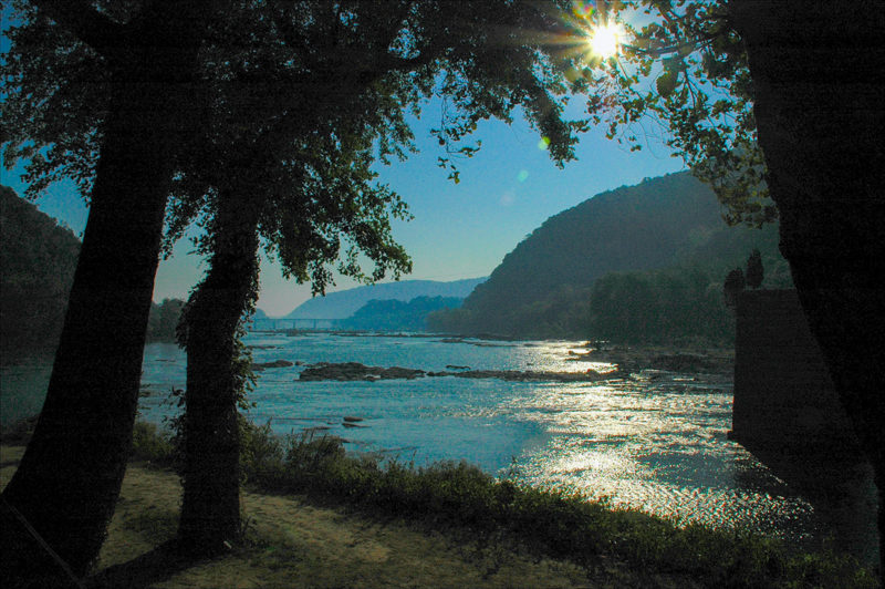
The river you imagine when someone says “the Shenandoah” depends entirely on which section you have seen. The South Fork is the one that shows up in summer photos: wide, green-shaded, and slow enough for a tube float that lasts three hours without a single paddle stroke. The North Fork is a different animal.
It runs narrower and faster, with more rock gardens and sections that genuinely require steering. The main stem below Front Royal combines both personalities, widening into a broad, steady river that carries you toward the Potomac.
South Fork
- Best for tubing and relaxed family floats
- Wide, calm, warm in summer
- Runs from near Waynesboro to Front Royal
- More outfitters and rental options
North Fork
- Best for canoeists and kayakers wanting current
- Narrower, faster, more technical sections
- Runs from near Timberville to Front Royal
- Fewer crowds, more remote feel
Main stem
- Best for multi-day canoe trips
- Broad, steady, scenic
- Front Royal to Harpers Ferry
- Passes through the Shenandoah Valley’s historic corridor
For a first-time visit, the South Fork wins. The water is forgiving, the access points are well-marked, and the outfitter infrastructure means you can show up without gear and still get on the water. The North Fork rewards people who already know how to read currents and want a quieter, more self-sufficient day.
Paddling and tubing the Shenandoah: put-ins, difficulty, and season
The river is floatable year-round, but the best paddling window runs from April through October. Spring delivers higher, faster water and a more engaged paddle, especially on the North Fork. Summer drops the water level, which makes the South Fork ideal for tubing but can leave the upper North Fork too shallow for loaded canoes. Fall offers cooler air, stable water, and the added drama of the Blue Ridge foliage reflecting off the surface.
Best put-in and take-out points by section
On the South Fork, a classic beginner float runs from Elkton to Shenandoah or from Shenandoah to Grove Hill. These stretches are gentle, wide, and dotted with gravel bars where you can pull over and swim. On the North Fork, the section from Edinburg to Woodstock gives you moving water and rock gardens without requiring whitewater experience. The main stem below Front Royal offers long, multi-day-capable floats, with the section from Front Royal to Watermelon Park near Berryville being a popular single-day canoe trip.
All these access points are public, but parking and launch conditions vary. Some are simple gravel ramps. Others have formal parking areas with a small daily fee. Check the specific access point on the Virginia Department of Wildlife Resources website before you drive, especially after heavy rain when launch ramps can flood or wash out. The USGS gauge at Front Royal is the reference point every paddler should check. A flow around 2 to 3 feet on the gauge generally means pleasant floating on the South Fork and adequate depth on the lower North Fork. Below 1.5 feet, the upper sections get bony. Above 5 feet, the current picks up, and beginners should stay off the water.
Difficulty ratings by stretch
The river is rated class I to III, with most of it sitting firmly in the class I to II range during normal summer levels. The South Fork is almost entirely class I, meaning moving flatwater with occasional riffles. The North Fork has several class II sections and, during high spring water, can reach class III in a few short ledges. The main stem runs class I to II, with the biggest consideration being wind and distance rather than whitewater. None of these ratings require a whitewater background at normal summer levels, but respect spring high waters.
Fishing the Shenandoah: what to catch and what to release
The Shenandoah is one of Virginia’s best smallmouth bass rivers. The South Fork in particular holds healthy numbers of smallmouth, plus redbreast sunfish, bluegill, and channel catfish. The North Fork runs cooler and clearer, which makes it better for smallmouth in the heat of summer. Spring and fall are the prime fishing seasons, when the water is cool and the fish are active in the shallows. Summer fishing holds up early and late in the day, but the afternoon bite slows considerably.
A Virginia freshwater fishing license is required for anyone 16 and older, whether you are fishing from a boat or from the bank. You can buy one online through the Virginia Department of Wildlife Resources. Out-of-state visitors pay a higher rate than residents, but the annual non-resident license covers the entire Shenandoah watershed.
Is it safe to swim or eat fish from the Shenandoah?
Swimming and wading are common and widely considered safe for casual contact in the summer. The river is not pristine, and after heavy rain it carries agricultural runoff and sediment, but the primary contaminant of concern, mercury, does not make the water unsafe for swimming. The concern with mercury is entirely about eating fish, not touching the water.
The Virginia Department of Health has maintained a fish consumption advisory for parts of the Shenandoah River watershed since a DuPont textile plant in Waynesboro released mercury into the South River, a Shenandoah tributary, from the 1930s through the 1950s. Mercury accumulates in fish tissue over time, and large predator fish like big smallmouth bass and catfish carry the highest concentrations. The current advisory is nuanced: certain species and sizes should be avoided entirely, others limited to a few meals per month, and some are safe to eat in moderation. Check the current Virginia Department of Health fish consumption advisory before you keep anything. The advisory is updated periodically as new testing data becomes available, so a blanket “never eat fish from the Shenandoah” statement is not accurate. It is also not accurate to say the fish are perfectly safe. The truth lives in the species-by-species guidance.
Maya’s honest take: “I practice catch and release on the Shenandoah. The river is a fantastic fishery, but given the mercury history and the complexity of the advisory, I would rather take the photo and put the fish back than try to remember which size class is safe this year.”
Camping near the Shenandoah River
The Shenandoah River corridor sits close to Shenandoah National Park, which offers developed campgrounds like Big Meadows and Mathews Arm with restrooms, potable water, and ranger programs. These campgrounds are not directly on the river, but they put you within a 30-minute drive of several put-in points. For riverfront camping, the private campgrounds along the South Fork, especially near Luray and Shenandoah, offer tent sites and cabins right on the water. Watermelon Park on the main stem near Berryville is a long-standing paddler favorite with riverfront tent camping and live music events during the summer.
Dispersed camping along the riverbank itself is generally not permitted outside designated areas, as much of the shoreline is private land. The public access points are launch sites, not overnight areas. Plan to use an established campground or a nearby national forest site, and respect the fact that the river’s beauty relies on landowners who have chosen not to post every inch of shoreline.
Mistakes to avoid on the Shenandoah River
The river is beginner-friendly enough that a lot of people underestimate it. These are the errors I have made or watched others make on summer weekends.
- Not checking the USGS gauge before driving out. Water levels change fast. A river that was perfect last weekend may be too low to float or too high for beginners this weekend.
- Assuming the North Fork will be like the South Fork. They are different rivers. The North Fork is faster, rockier, and less forgiving for first-timers.
- Floating past your take-out. The South Fork has multiple access points close together, and it is easy to miss your exit if you are not watching for signs. Identify your take-out by a distinctive landmark before you launch.
- Forgetting sun protection for a four-hour float. There is no shade on the water. A full day of tubing without a hat, sunglasses strap, and reef-safe sunscreen will ruin the next day.
- Wearing cotton clothing for a paddle. If you end up in the water, wet cotton gets cold and heavy. Quick-dry fabric or a swimsuit is the right call.
- Eating fish without checking the current advisory. The advisory changes as new data comes in. What was safe last year may not be the recommendation this year.
- Leaving valuables in your car at isolated put-ins. Break-ins at rural launch areas are rare but not unheard of. Lock valuables out of sight or leave them home.
Frequently asked questions
Is the Shenandoah River good for beginners?
Yes, the South Fork in particular is one of the best beginner paddle and tubing rivers in the Mid-Atlantic. The water is generally slow and wide, with no significant whitewater at normal summer levels. Total beginners should stick to the South Fork between Elkton and Front Royal. The North Fork requires more experience reading current and maneuvering around rocks.
How long does it take to canoe the Shenandoah River?
A typical one-day South Fork canoe float covers 6 to 10 miles and takes 3 to 5 hours at a relaxed pace with stops. The full main stem from Front Royal to Harpers Ferry, roughly 55 miles, is usually done as a 3-day to 4-day multi-night trip. Tubing floats are shorter, often 3 to 4 miles over 2 to 3 hours depending on water level and wind.
Can you swim in the Shenandoah River?
Yes, swimming and wading are common on the South Fork and main stem during summer. The water is generally warm and slow enough for comfortable swimming. After heavy rain, agricultural runoff and sediment make the water murkier, and swimming in flood-stage water is dangerous. The mercury contamination that affects fish does not make normal swimming contact unsafe.
Do you need a permit to fish the Shenandoah River?
You do not need a special Shenandoah-specific permit, but you do need a valid Virginia freshwater fishing license if you are 16 or older. The license covers the entire river, both forks, and all public access areas. Out-of-state visitors can purchase a non-resident license online through the Virginia Department of Wildlife Resources.
What is the difference between the North Fork and South Fork?
The South Fork is wider, slower, and warmer, making it ideal for tubing and casual floats. The North Fork is narrower and faster with more rock gardens and a more remote feel. They join near Front Royal to form the main Shenandoah River. If you want a relaxing day, choose the South Fork. If you want a more technical paddle, choose the North Fork.
Is the Shenandoah River safe for dogs?
Yes, many people bring dogs on South Fork floats and to riverside campgrounds. Bring a dog life jacket, especially for longer paddles, and provide plenty of shade and fresh water. On hot days, the rocks at put-ins and take-outs can be sharp and hot enough to hurt paw pads. Check the water quality advisory after heavy rain, since dogs drink river water while swimming.
Why is the Shenandoah River famous in songs?
The river appears in the traditional American folk song “Oh Shenandoah” and is referenced in John Denver’s “Take Me Home, Country Roads.” Both songs associate the river with longing, home, and the Blue Ridge Mountains. The name itself is commonly translated as “daughter of the stars,” though the exact etymology remains debated among historians.
Plan your trip: booking platforms we trust
For a Shenandoah River trip, you need three things: a place to stay, reliable gear, and current water conditions. The platforms below cover the first two. For the third, always check the USGS gauge directly.
Best for finding hotels, inns, and cabins near Front Royal, Luray, and Harpers Ferry with flexible cancellation.
Best for booking whole riverfront houses and cabins for family tubing weekends and group paddling trips.
Best for booking guided kayak and tubing excursions with gear included if you do not want to plan logistics yourself.
Best for reading recent reviews of specific Shenandoah River outfitters and campgrounds before you book.